Dust Cloud Sweeps in From Drought-Hit South Australia
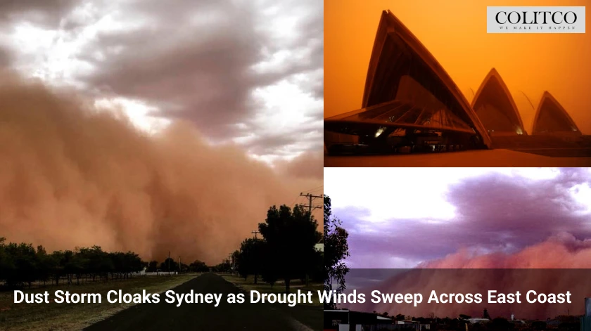
A massive dust storm from South Australia swept across coastal New South Wales on Tuesday, blanketing Sydney in a yellow haze. The storm reduced visibility to 300 metres in some areas and triggered an air quality alert across the city. The Bureau of Meteorology confirmed the dust originated in drought-affected parts of South Australia and western Victoria.
Jiwon Park from the bureau said one of the year’s strongest cold fronts had stirred up dust clouds across inland regions. “Instead of the dust being settled, it kept moving, impacting Canberra and the Southern and Central Tablelands,” Park said.
A dust storm blasting in from drought-stricken South Australia hit coastal NSW on Tuesday morning, blanketing towns in a yellow-tinged haze, cutting visibility to 300 metres in some areas and sparking an air quality alert for Sydney. pic.twitter.com/nntzzzlOGp
— Evan S. (@fictillius) May 27, 2025
Air Quality Plunges Across Sydney and Illawarra
The dust storm pushed air quality in parts of Sydney and the Illawarra to “extremely poor” levels on Tuesday morning. Residents in affected suburbs were advised to stay indoors and reduce outdoor activity.
The storm formed as strong westerly winds lifted loose topsoil from dry areas and carried it across hundreds of kilometres. Adelaide has only recorded 36 millimetres of rain this year, about 21 per cent of its yearly average. The dry ground in South Australia created ideal conditions for dust mobilisation.
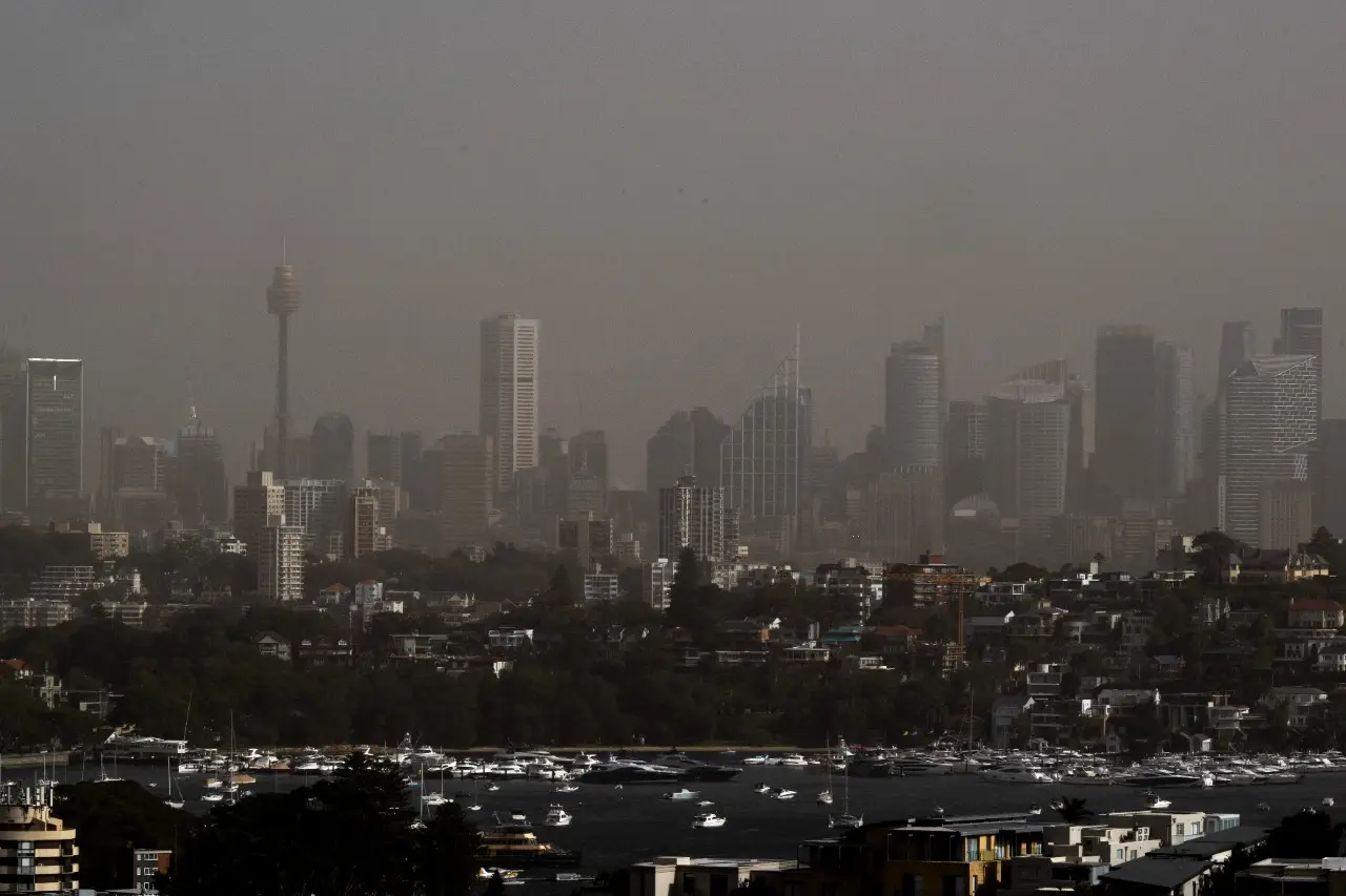
The City can be barely seen from Dover Heights
Cold Front Fuels Destructive Winds Across South-East
Destructive winds reaching 70km/h swept through Victoria on Monday, knocking out power to 3,500 properties north of Bendigo. The wind carried the dust cloud over 600 kilometres, stretching from South Australia into Victoria and south-west New South Wales by Monday afternoon.
As the storm moved east, it reached the Southern and Central Tablelands before blanketing Sydney early Tuesday. Park said, “It’s surprising because over our side it’s been quite wet, but this dust has managed to reach eastern NSW including Sydney.”
Unseasonal Event Covers Towns in Orange Haze
The towns of Orroroo in South Australia and Mildura in Victoria saw the most intense impacts, covered in thick orange haze. The Bureau of Meteorology noted it was rare to see such a storm in late autumn, as similar events usually occur during summer.
Although the haze thinned before reaching the coast, Sydney still experienced significant disruption. Flights remained largely unaffected, unlike the 2009 “red dawn” storm that grounded aircraft and caused a $300 million clean-up.
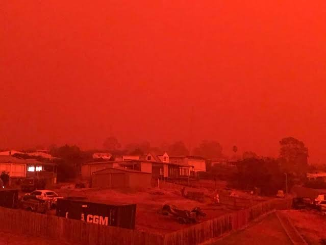
Sydney in 2009 ‘Red Dawn’ storm
Visibility Drops at Camden Airport as Dust Settles
Visibility fell to 300 metres at Camden Airport in Sydney’s south-west on Tuesday morning. The dust cloud lingered into the early afternoon before westerly winds began pushing it out to sea. Park said the haze would continue clearing throughout the day.
Public Health Warning Issued for Affected Regions
Health authorities urged residents across Sydney, Wollongong, and the South Coast to stay inside during peak dust levels. Officials advised closing all windows and doors and avoiding outdoor physical activity until air quality improved.
Air quality monitors detected elevated levels of airborne particles across the region, prompting an alert from the NSW Department of Health. Vulnerable groups, including the elderly and people with respiratory issues, were especially advised to take precautions.
Drought Conditions Persist in South Australia
Low rainfall in South Australia this year has worsened drought conditions across the state. Adelaide’s rainfall stands far below its normal average, contributing to dry surface soils. The city’s desalination plant has ramped up output in response.
Some regional towns now depend on trucked-in water to replenish rain tanks, and water restrictions remain in effect across multiple communities.
Wind Conditions Expected to Ease Midweek
Meteorologists expect the worst of the dust storm to pass by late Tuesday, with improving air quality by Wednesday. The bureau forecasts a shift in wind patterns that will disperse remaining dust over the Tasman Sea.
Residents are advised to remain cautious and monitor official warnings as the weather system moves away from the coast.
Authorities Monitor Dust Impacts on Infrastructure
Transport and emergency services continue assessing the dust storm’s impact on roads, visibility, and infrastructure across the state. No major disruptions to flights or public transport were reported, though minor delays occurred on regional routes.
Authorities remain prepared for future events as dry inland conditions and cold fronts increase the risk of more dust storms in coming months.