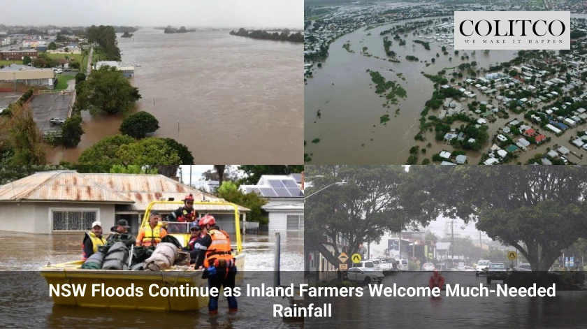
Record Deluge Hits Mid North Coast
Heavy rainfall continues to batter New South Wales, with record May totals falling across the Mid North Coast. Taree recorded 279mm in 24 hours to 9 a.m. Tuesday, setting a new May rainfall record. The Manning River rose more than 12 metres in 12 hours, prompting a major flood warning for the region.
Port Macquarie received 239mm during the same period, marking its highest May total and the heaviest single-day rainfall since 1974. Flood warnings were also issued for the Hastings River after the city endured a widespread soaking.
Further major warnings covered the Paterson, Williams, and Gloucester rivers following relentless downpours on Tuesday. Rain continued falling through the afternoon, saturating catchments already at capacity.
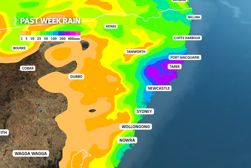
Figure 1: Over 200mm had already fallen this week by 9 am on Tuesday
Rainfall Belt Expands Along the Coast
The rainfall belt is forecast to continue from Yamba to the Central Coast throughout Wednesday as the Tasman Sea’s onshore airstream feeds moisture into a stationary trough over the coastline.
Forecasts suggest rainfall totals will again exceed 100mm in many of the already-flooded regions, and the weather system is expected to shift south on Thursday, delivering heavy falls to Sydney and the Illawarra while the hardest-hit areas in the north remain vulnerable to another day of intense rainfall.
By Friday, the rain should move further down the coast, bringing moderate falls to the NSW South Coast, and sunshine is forecast to return to the sodden Mid North Coast and Upper Hunter catchments by the weekend.
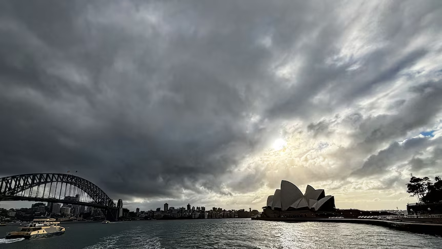
Figure 2: Sydney encountered just four dry days over the last four weeks
Coastal Communities Face Repeated Flood Risk
Communities along the coast, many of which have only recently recovered from the 2021 and 2022 floods, are again preparing for widespread disruptions as emergency services brace for prolonged wet conditions.
Schools across Port Macquarie and Taree closed for the second consecutive day, while local councils began distributing sandbags and opening evacuation centres ahead of the forecast peak rainfall.
Authorities warn that flash flooding is likely to continue even after rain stops due to overwhelmed drains and saturated soils.
Inland Regions Await Rain Relief
While the coast endures flooding, a new weather system is emerging inland, offering potential relief to drought-affected farmers as an upper-level low drifts over south-east inland Australia, shifting the stalled moisture-laden air mass.
This low-pressure system, with its clockwise wind flow, is pushing rain across the Great Dividing Range and into the Murray Basin, and the first showers are forecast to hit the Central West and Riverina today before spreading across western NSW by Thursday.
For farmers who have watched storm systems bypass their properties for months, this change brings cautious optimism.
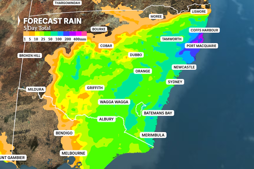
Figure 3: 5-day rain forecast
Autumn Break Forecast for Murray Basin
By Friday, rainfall is expected to expand across southern NSW and move into central and eastern Victoria, and models indicate totals between 10mm and 40mm across the NSW Central West, Southwest Slopes, Riverina and Victoria’s North East by Saturday.
The higher end of these totals would represent the heaviest rainfall in months and mark the long-awaited autumn break for inland agriculture, though with nine-month deficits ranging from 75mm to 300mm across the southern Murray Basin, repeated rain events will still be needed to ease drought conditions.
Growers say even moderate falls will help prepare paddocks for winter planting, especially for cereal and pasture crops.
Cold Front Approaches South Australia
As the eastern seaboard remains soaked, South Australia and far western Victoria are set to receive rain from a cold front arriving Sunday through Tuesday, with the strongest falls expected along the southern coastline.
This front will lack pre-frontal rain but will still deliver 20mm or more from Eyre Peninsula to Wilsons Promontory, including Kangaroo Island, Mount Gambier and Warrnambool, while rainfall will weaken further inland with regions such as the Riverlands and Mallee expecting no more than a millimetre or two.
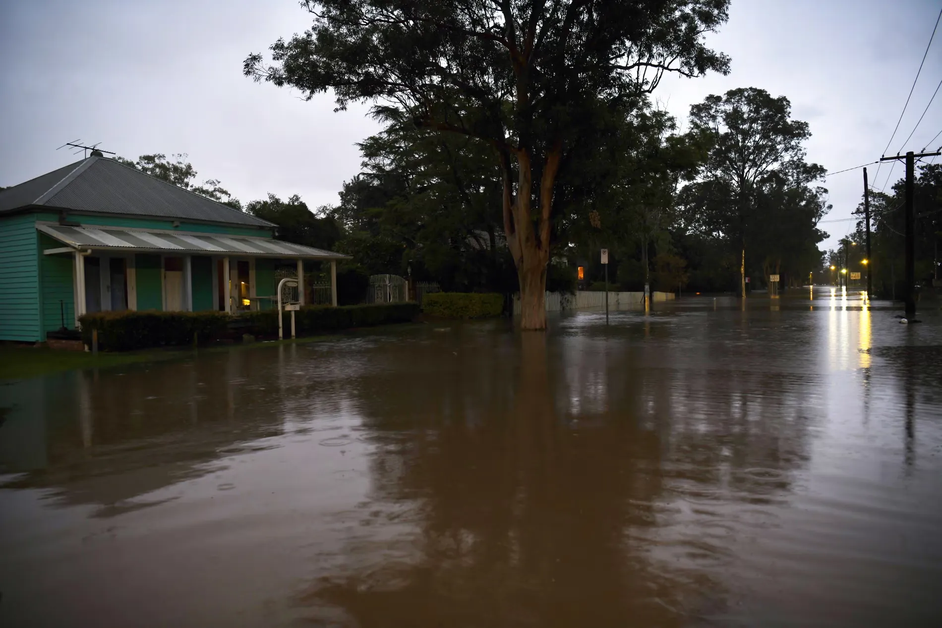
Figure 4: Rising flood waters in Raymond Terrace
Strong Winds to Accompany Front
The system will also bring 48 hours of damaging winds, with gusts exceeding 100kph likely to trigger multiple severe weather warnings across southern Australia.
Boaters and campers are urged to reconsider travel plans, and local emergency crews are preparing for fallen trees and power outages.
Also Read: Westpac Set to Slash Workforce by 1,500 as Banking Sector Faces Ongoing Shake-Up
SES Responds to Emergency Calls
More than 48,800 people and 23,200 dwellings are isolated due to floodwaters in the Mid North Coast region, and the State Emergency Service has conducted 284 rescues in the past 24 hours, deploying nine helicopters across the region with rescue efforts concentrated in Taree, Wingham and Glenthorne.
Premier Chris Minns confirmed that priority is being given to people stranded on rooftops or facing immediate danger, while Glenthorne resident Jordan Halloran described a harrowing night as she, her partner and their two-year-old son awaited rescue.
By noon Wednesday, Halloran confirmed they had been rescued by helicopter and shared a video of the event online.
Authorities Urge Caution and Preparedness
NSW SES Commissioner Mike Wassing said the slow-moving system continues to affect the Hunter and north coast regions, and emergency services remain focused on areas including Coffs Harbour, South Taree and Glenthorne.
Northern zone commander Andrew Cribb advised residents in the Hastings, MacLean and Nambucca catchments to prepare for evacuation or isolation.
Cribb warned that flood warnings will escalate quickly and urged communities to act early, rather than wait for official orders.
Flooding Expected to Continue
Bureau meteorologist Dean Narramore warned of more rainfall between 50mm and 150mm for areas north of Forster on Wednesday, with isolated falls of 200mm possible.
He said some regions have already received 300mm to 400mm, with Taree receiving even more, causing extensive flash flooding and river inundation.
Locals near the Manning River were ordered to evacuate on Tuesday night, and the Pacific Highway remains closed in several sections.
More evacuations and road closures are expected over the next 48 hours.