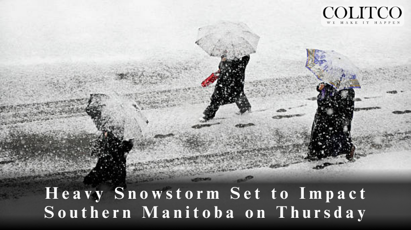
Residents of southern and south-central Manitoba are bracing for a significant snowstorm set to arrive on Thursday, with forecasts predicting snowfall accumulations between 10 to 20 centimetres over a 24-hour period. The storm is expected to bring localized blowing snow, reduced visibility, and hazardous travel conditions.
Snowfall Warnings Issued
On Wednesday, Environment and Climate Change Canada (ECCC) issued snowfall warnings for a large section of western Manitoba, covering areas west of Lake Winnipegosis and Lake Manitoba. Affected regions include:
- Porcupine Provincial Forest
- Duck Mountain
- Dauphin
- Riding Mountain National Park
- Russell and Minnedosa
The storm is expected to begin late Thursday afternoon, with heavy snowfall persisting through the night and into Friday morning before tapering off by early Saturday.
Travel Disruptions Expected
Authorities are warning residents of the affected regions to exercise extreme caution while traveling. The rapid accumulation of snow, combined with strong winds, is expected to create dangerous driving conditions with reduced visibility.
“Travel will become increasingly hazardous as snow intensifies late Thursday into Friday,” said an ECCC spokesperson. “Motorists are advised to drive according to conditions, allow extra travel time, and be prepared for sudden weather changes.”
Special Weather Statement for Winnipeg and Brandon
While snowfall warnings are primarily concentrated in western Manitoba, Winnipeg and Brandon are also expected to receive heavy snow. Environment Canada has issued a special weather statement for these areas, cautioning residents about potential rapid snow accumulation and worsening conditions throughout the day on Friday.
As of Wednesday evening, meteorologists remained uncertain about the exact track of the storm, leaving Winnipeg and Brandon on the fringes of the heaviest snowfall. Officials warn that additional snowfall warnings may be issued as the system progresses eastward.
Also Read: SIX MINING Cloud Mining: Advantages and Guarantees Coexist
Storm System Origin and Development
This winter storm is being driven by a developing low-pressure system in Alberta, which is expected to push across the Saskatchewan border into southwestern Manitoba. As it intensifies, it will bring a mix of strong winds and significant snowfall, creating blizzard-like conditions in some regions.
Meteorologists say that the storm’s path and intensity will determine the exact areas experiencing the highest snow accumulation. “As the system advances, some areas may see more than 20 cm of snowfall, particularly where bands of heavy snow set up,” an ECCC meteorologist noted.
Potential Impact and Precautions
Residents across southern Manitoba are urged to take necessary precautions as the storm approaches. Key safety recommendations include:
- Avoid unnecessary travel during peak snowfall periods.
- Stock up on emergency supplies, including food, water, flashlights, and batteries.
- Monitor local weather updates for real-time changes to storm intensity and trajectory.
- Prepare vehicles with winter tires, extra blankets, and an emergency kit in case of roadside delays.
With winter storms of this magnitude, power outages and disruptions to transportation services are possible. Manitoba Hydro and local municipalities have advised residents to report any downed power lines or outages immediately.
Emergency Response and Road Maintenance
Manitoba’s highway maintenance crews are already preparing to deploy snowplows and sanding trucks to keep major routes as clear as possible. However, drivers are advised that highways may become impassable in some areas, and temporary road closures could be necessary.
The province’s emergency response teams are also on alert, coordinating efforts to assist stranded motorists and manage any storm-related emergencies. “We encourage residents to stay home if possible and only travel if absolutely necessary,” said a spokesperson from Manitoba Transportation and Infrastructure.
Looking Ahead: The Aftermath of the Storm
The storm is expected to weaken by Saturday, allowing for gradual improvements in travel conditions. However, lingering blowing snow and drifting could continue to cause visibility issues into the weekend. Icy roads and snow-covered highways may also slow post-storm cleanup efforts.
Meteorologists warn that this could be one of the season’s most impactful storms, depending on how the system develops. “If the storm shifts slightly east or intensifies further, Winnipeg and other areas could see higher snowfall totals than currently forecasted,” an ECCC meteorologist stated.
Stay Informed and Stay Safe
Environment Canada will continue monitoring the system, providing updates as conditions evolve. Manitobans are encouraged to stay informed through official weather advisories, local news sources, and emergency alert systems.
Residents should also check road conditions before heading out and ensure they are adequately prepared for winter weather challenges.