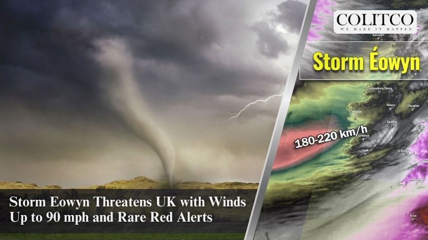
The UK braces for the arrival of Storm Eowyn, bringing strong winds, heavy rain, and rare red warnings. Coastal areas in southern and southwestern England, along with Wales, face significant risks on Thursday. The Met Office has issued yellow, amber, and red weather warnings, signalling the potential for dangerous conditions and widespread disruption.
Weather Warnings in Effect
The Met Office has placed yellow weather warnings for wind across Wales and southern England from 7 am to 6 pm on Thursday. Winds could hit 50-60 mph over exposed coasts and hills, with peak gusts expected during the morning in western areas and the afternoon in eastern regions.
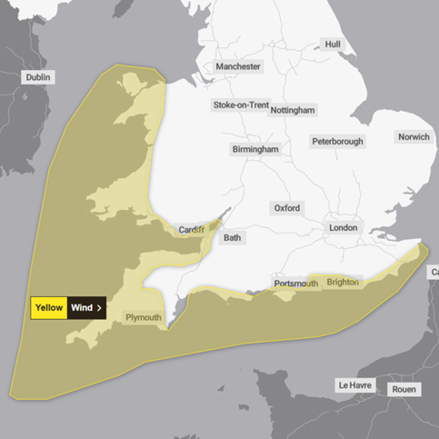
Figure 1: A yellow wind warning for Thursday forecasts gusts reaching 50 to 60 mph.
On Friday, amber wind alerts will cover parts of the UK from 6 am to 9 pm. Areas in northern England and Scotland are forecast to experience gusts between 60-70 mph. Coastal areas may see stronger winds reaching up to 90 mph. The Met Office warns of “danger to life” caused by flying debris.
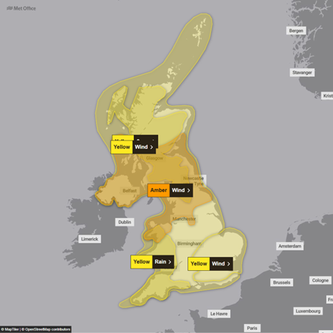
Figure 2: The Met Office has issued yellow and amber warnings for Friday in anticipation of Storm Eowyn.
Rare Red Warning Issued in Ireland
Ireland’s weather service, Met Éireann, has issued a rare red wind warning for all 26 counties. This level of alert is reserved for extreme weather conditions. The storm threatens to bring “severe, damaging, and destructive gusts,” with speeds exceeding 130km/h (80mph). Gale-force winds will sweep across the country, turning westward by Friday afternoon. Met Éireann warns of fallen trees, power outages, structural damage, and dangerous coastal waves.
Northern Ireland also faces amber warnings for strong winds on Friday. These conditions will likely cause travel disruptions, with warnings for high-sided vehicles, caravans, and motorbikes.
Storm Eowyn’s Path and Impact
Storm Eowyn will reach Northern Ireland early Friday morning before moving northeast across Scotland. The storm’s centre is expected to be near Shetland by Friday evening. The Met Office describes the storm as an explosive cyclogenesis or “weather bomb,” caused by a dramatic drop in air pressure.
This storm follows a powerful jet stream pushing low pressure across the Atlantic, leading to strong winds, heavy rain, and snow in parts of the UK. “Up to 10cm of snow is expected over hills in northern England and southern Scotland,” said a Met Office meteorologist. In northern Scotland, snowfall could reach 25cm.
Travel Disruptions and Warnings
National Highways has urged motorists in the North West, North East, and Yorkshire to prepare for travel disruptions on Friday. High-sided vehicles, motorbikes, and caravans face a high risk of being blown over. The Britannia Bridge, connecting Anglesey to Bangor, may close due to high winds, according to Traffic Wales.
Rail passengers in northern England also face significant delays. LNER announced it would halt services north of Newcastle from 11 am on Friday. Trains north of York may also face cancellations and delays. “Alternative travel options will be limited due to the weather,” an LNER spokesperson stated.
Tornado Risk in the UK
The European storm forecasting group, Estofex, issued a level 2 alert for the UK on Thursday and Friday. Forecasters warn of a “risk of a few tornados,” particularly along a line south of Bristol and London. These tornados could travel long distances due to the rapid movement of thunderstorms.
Advice for Residents
The Met Office advises securing loose items outside homes to reduce risks from flying debris. The agency also warns of substantial disruptions to travel, energy supplies, and possible damage to property and infrastructure. Residents in affected areas should prepare for potential power outages and dangerous conditions.
Deputy Chief Meteorologist Mike Silverstone stated that the storm’s impacts will cover “all parts of the UK” on Friday. He highlighted the widespread disruption expected across Northern Ireland, Scotland, and northern England.
Stay Informed
Storm Eowyn represents one of the most significant weather events of the season. With red, amber, and yellow warnings in place, it is crucial to stay updated through the Met Office and local authorities. Prepare for hazardous conditions, particularly in coastal and exposed areas, as the storm intensifies.
Last modified: January 23, 2025