BOM Issues Statewide Severe Weather Warnings
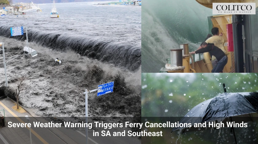
The Bureau of Meteorology issued multiple severe weather warnings for damaging winds and dangerous tides across South Australia. Eyre Peninsula, Yorke Peninsula, Mount Lofty Ranges, and Adelaide faced the highest alerts. Kangaroo Island, the Mid North, Flinders, Riverland, and Murraylands were also included. Forecasts predicted gusts reaching 110km/h in coastal areas.
⚠️Coastal Hazard Warning current for Abnormally High Tides Mon 26/5.
Inundation of low-lying coastal areas of Spencer Gulf and Gulf St Vincent may occur with the afternoon and evening high tides. Large surf may also cause coastal erosion. Stay up-to-date: https://t.co/65UuhSgpkD pic.twitter.com/wC0p2tGT5O— Bureau of Meteorology, South Australia (@BOM_SA) May 25, 2025
Kangaroo Island Ferries Halted Amid High Winds
SeaLink cancelled all Kangaroo Island ferry services on Sunday due to dangerous sea conditions and increasing wind gusts. Morning sailings from Cape Jervis and Penneshaw were cancelled first, followed by a full-day suspension. The company stated, “All sailings for today, 26 May will not be operating.” SeaLink confirmed it would monitor forecasts for Tuesday, 27 May.
SES Urges Caution Over Stressed Trees and Loose Items
State Emergency Service duty officer Brad Flew warned about the risk of falling trees after months of drought. “We’ve got plenty of stressed trees, so there’s an increased risk of branches falling,” he said. The SES advised residents to stay clear of trees and avoid parking beneath them. It also urged people to secure loose outdoor items before wind conditions worsened.
Widespread Rain and Strong Winds Across Adelaide
BOM senior forecaster Simon Timcke said between six and 20 millimetres of rain were expected across Adelaide. Rainfall in the Adelaide Hills could reach up to 40 millimetres. Timcke said, “The prevailing winds will be pretty strong and gusty.” He added thunderstorms could increase gust speeds and produce more damage than the frontal system alone.
🌦️Showers and patchy rain for much of inland NSW, spreading to the coast at night.
⛈️Possible thunderstorms on and west of ranges.
❄️Late snow on the southern ranges above 1600 metres.
🌬️Strong to gale force winds for Alpine peaks, fresh and gusty winds elsewhere. pic.twitter.com/STkZPqkziO
— Bureau of Meteorology, New South Wales (@BOM_NSW) May 25, 2025
Local Councils Prepare for Coastal Flooding
Port Adelaide Enfield Mayor Claire Boan said the council was on “high alert” for flooding along the coast. Areas from Semaphore to Birkenhead were being monitored due to high tides and coastal surges. Boan said, “We’re expecting [flooding] to come from the high tide, in terms of the risk to properties.” She confirmed staff were clearing sites and preparing sandbags for emergency use.
⚠️Coastal Hazard Warning current for Abnormally High Tides Mon 26/5.
Inundation of low-lying coastal areas of Spencer Gulf and Gulf St Vincent may occur with the afternoon and evening high tides. Large surf may also cause coastal erosion. Stay up-to-date: https://t.co/65UuhSgpkD pic.twitter.com/wC0p2tGT5O— Bureau of Meteorology, South Australia (@BOM_SA) May 25, 2025
Low Pressure System Drives National Weather Event
A deep low pressure system south of SA triggered a chain of cold fronts moving through southeastern Australia. Timcke said the system arrived later than expected but was intensifying. “There’s a couple of pretty vigorous fronts extending from that low,” he said. Showers began late Sunday and spread rapidly across the region by Monday morning.
Calls for Help Increase as Weather Worsens
The SES confirmed rising calls for assistance from multiple regions including Coffin Bay and the lower south-east. Brad Flew said, “We’re expecting some extreme weather, and some coastal conditions that are less than favourable.” The service reported high winds, strong wave activity, and unusually high tides across coastal communities.
Cold Front Impacts Millions in Southeast Australia
The Bureau of Meteorology said millions across southeastern Australia were affected by damaging winds and severe conditions. Senior Meteorologist Dean Narramore said the front brought “strong and damaging winds” overnight. Wind speeds reached 113km/h at Neptune Island in SA and 122km/h at Mt William in Victoria. Tasmania also reported gusts near 93km/h at Mt Reed and Mt Thredbo.
Victoria, NSW, and ACT Face Wind Warnings
Updated warnings covered elevated areas of Victoria, southern NSW, and the ACT. Winds of up to 100km/h were expected across the Snowy Mountains and South West Slopes. For areas above 1400 metres, average winds of 60 to 70km/h were forecast, with gusts near 100km/h. Locations included Mount Ginini, Perisher Valley, Charlotte Pass, Thredbo Top Station, Cabramurra and Selwyn.
Also Read: Sydney Trains Go Free After Week of Disruptions and Commuter Delays
Hazards from Trees and Power Infrastructure
The Bureau’s Jonathon How said dry conditions across autumn had weakened trees throughout the southeast. “We could see high numbers of fallen trees and branches causing damage to property,” he said. He warned of possible disruptions to power infrastructure and dangerous driving conditions during peak gust periods.
Blizzard Conditions Expected in the Alps
Snow was forecast to fall across the Australian Alps from late Monday into Tuesday. The BOM said blizzard-like conditions could form as winds combine with snow at higher elevations. Temperatures were expected to drop well below average across elevated regions, adding to travel concerns for mountain areas.
Northeast Faces Rain and Flood Warnings
While the southeast battled wind and flooding, the northeast also braced for unseasonal rainfall and cold conditions. A flood watch remained active for the West Kimberley and Fitzroy Rivers in northern Australia. Initial flood alerts were issued for the Sturt Creek District, Tanami, Central, and Western Desert catchments in the Northern Territory. The northeast was forecast to receive heavy rainfall throughout the week.
Tide Alerts Remain in Place for SA Gulfs
Warnings for abnormally high tides extended across the Spencer Gulf and Gulf St Vincent. Forecasters said seawater flooding was likely in low-lying coastal areas. Dangerous beach conditions persisted for much of the Adelaide coastline, with access points at risk of erosion and surge