

The government of Canada launched a central platform to accelerate reviews for resource extraction and infrastructure developments. Natural Resources Canada created the Open Science and Data Platform to consolidate information for regulators and the public. This system coordinates geospatial records, environmental monitoring metrics, and maps.
The platform links multiple data streams into a single portal to assist the federal Major Projects Office. This setup allows users to evaluate projects without managing files across multiple jurisdictions. The initiative aims to clear regulatory backlogs that delay industrial development.
Administrators designed the portal to provide public access to scientific findings and government records. Users view data layers to evaluate the cumulative impacts of industrial operations. The technology provides a uniform baseline for environmental assessments across the nation.
The platform resolves data inconsistencies by applying verification algorithms to uploaded files. Government scientists check conflicting submissions against baseline maps before approving the entries. This verification step guarantees data integrity for all portal users.
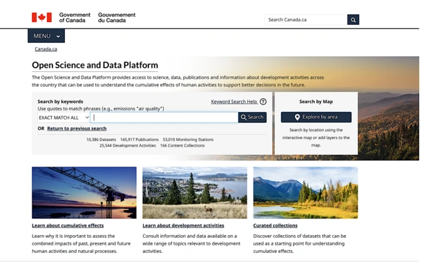
Figure 1: The platform aims to cut years from Canada’s mine reviews [Source:OSDP]
The system combines data feeds from multiple branches of government:
- Geological surveys supply terrain data and rock composition records.
- Wildlife departments upload habitat boundaries and migration corridors.
- Water authorities provide watershed maps and flow velocity metrics.
- Climate stations transmit atmospheric data and temperature logs.
Significance
Permitting delays often stall resource extraction ventures for years in North America. A report from PricewaterhouseCoopers indicates that mine construction in Canada takes six years longer than in Australia. This lag reduces economic competitiveness and delays the supply of materials for manufacturing.
Slow approvals directly impede the transition toward technology deployments and electric vehicle production. Factories require a supply of lithium, nickel, and copper to manufacture batteries. This system aims to resolve supply bottlenecks by shortening the regulatory pipeline.
Global markets demand production timelines that outpace legacy systems. Countries that modernise their permitting infrastructure attract mining investments ahead of jurisdictions with manual processes. This project positions Canada as a supplier within the minerals market.
Citizens gain transparency during resource development projects within their home regions. The platform allows community members to examine the datasets that corporations submit to the state. This access builds trust and clarifies the environmental footprints of proposals.
The system delivers clear advantages for stakeholders:
- Mining firms reduce baseline study costs by accessing records.
- Regulatory bodies expedite decision timelines through automated data updates.
- Communities monitor environmental compliance using government maps.
- Indigenous groups protect territorial sovereignty via data access controls.
Key Stakeholders
Natural Resources Canada manages the platform architecture through its scientific divisions. The platform directly supports the Major Projects Office, which oversees infrastructure development. Government personnel, mining executives, and Indigenous leaders interact inside this data ecosystem.
Corporations like Newmont participate by feeding project specifications into the database. Newmont utilises the platform to advance its Red Chris mine expansion plan in British Columbia. The copper and gold extraction sector represents a beneficiary of this technology.
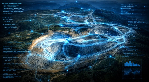
Figure 2: The OSDP provided centralized data to support the review of Red Chris mine expansion [Mine photo by Newmont]
Technology consortiums like DIGITAL co-invest capital alongside mining firms to create tools for the platform. These groups connect software developers with industrial buyers to validate tracking programs in real-world environments. The collaboration accelerates the adoption of tech solutions across the mining industry.
Sonja Kosuta, Senior Director of Impact Assessment at Natural Resources Canada, manages project integration. Kosuta detailed the goals during the rollout announcement:
“By providing centralised access to authoritative scientific data, environmental monitoring information and regulatory records, this really makes the impact assessment process more efficient for proponents and regulators, while increasing transparency for all Canadians,”
Colter Kelly serves as the Senior Impact Assessment Officer for the department. Kelly highlighted the capabilities of the mapping layers for regional analyses. Mining technology developers also interface with the network to supply analytical tools.
The initiative involves entities across the resource sector:
- Natural Resources Canada provides the administrative and technical framework.
- The Major Projects Office coordinates federal environmental assessments.
- Newmont applies the portal data to its mining properties.
- Indigenous communities maintain oversight of traditional territory boundaries.
Geographic Scope
The development originated in Ottawa through federal ministries coordinating data policies. The application covers landmasses across all Canadian provinces and northern territories. The system targets resource zones like the Golden Triangle in British Columbia.
Regional offices in British Columbia supply local environmental monitoring inputs to the core portal. The mapping covers specific watersheds, transmission pathways, and community perimeters near exploration sites. This integration links mining properties directly to regulatory offices in metropolitan centres.
The platform also incorporates jurisdiction data from Ontario and Sudbury mining hubs. These locations provide soil chemistry metrics, vegetation distributions, and water quality statistics. The geographical scope ensures coverage across mineral reserves.
The data system addresses infrastructure deficiencies in northern territories by mapping all-season roads and grid connections. Infrastructure planning improves when developers access route maps and terrain surveys from a single database. The mapping service grid extends into the Arctic circle to cover grassroots exploration zones.
The system maps physical features across the country:
- The Golden Triangle region tracks mineral extraction proposals.
- British Columbia watersheds supply hydrological data points.
- First Nation territories define treaty boundaries on maps.
- Northern transmission lines mark energy infrastructure pathways.
Also Read: EQ Resources Drives Spain’s Tungsten Future with Barruecopardo Restart
Project Timeline
The federal government initiated the Major Projects Office in 2025 to modernise regulatory oversight. Natural Resources Canada launched the data hub public portal on 14 July 2026. This release followed years of software development and multi-government database integration.
The agency populated the system with decades of historical environmental assessments during the preliminary phases. Regulators began using the portal for active mine reviews during the first quarter of the year. The system now updates its metrics continuously through real-time application programming interfaces.
The federal government expanded its critical minerals list to 34 materials prior to the platform launch. Regulators added high-purity iron ore, phosphorus, and silicon metal during the 2024 update cycle. The platform immediately integrated tracking layers for these listed commodities.
The department plans to implement artificial intelligence features during the next phase of expansion. Development schedules indicate that machine-readable conversions of paper archives will conclude within two years. The data expansion will continue through the end of the decade.
The project timeline includes milestones:
- The government established the Major Projects Office in 2025.
- Natural Resources Canada opened the platform to the public in July 2026.
- Technical teams will integrate artificial intelligence search tools by 2028.
- Analysts will finalise historical paper conversions before 2029.
Implementation & Outlook
The platform connects data repositories using application programming interfaces rather than static uploads. When a provincial agency updates a wildlife map, the change populates the central hub instantly. This mechanism ensures that all parties work from the same baseline information.
Proponents save capital by avoiding duplicate environmental baseline studies. Kosuta explained the economic rationale behind the data sharing arrangement:
“Having access to all this data that’s produced through the government system avoids duplication because companies don’t have to reproduce studies or data that’s already publicly available,”
The architecture organises information categories into visual layers. Kelly described the user interface and data aggregation method:
“It creates an ecosystem where the datasets used throughout the assessment process are all in one place,”
Kelly added details regarding specific data elements within the application:
“Whether you’re looking at roads, land cover, First Nation locations or existing monitoring stations, you can layer everything together or download the raw data for further analysis.”
The platform currently attracts 200,000 users according to metrics from Natural Resources Canada. Approximately 70 per cent of these visitors return to the portal multiple times for research. This pattern indicates adoption across the resources sector and community groups.
Future iterations will introduce artificial intelligence to categorise metadata and improve search precision. The government intends to include non-government research papers to expand the scientific baseline. Administrators will apply protocols to protect Indigenous data sovereignty throughout this expansion.
Disclaimer:
This article is based on information from the referenced sources and is for informational purposes only. It does not constitute official government policy or professional advice. Readers should consult official government channels for the most current and authoritative information.
Sources
- https://www.mining.com/canada-bets-on-digital-hub-to-speed-mine-permitting
- https://discoveryalert.com.au/digital-mining-innovation-funding-ai-restoration-canada

Luke Carlino is a seasoned Copywriter, Content Strategist, and Social Media Manager specialising in Mining, Finance, and Business journalism. With more than a decade of industry experience, he brings rigorous editorial standards and commercial acuity to every project.