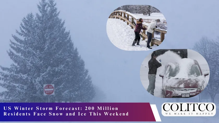
A massive winter storm will sweep across the United States this weekend. It will bring snow and ice to 200 million people. The system begins on Friday and continues through Monday morning. Cold air from the Arctic will drive this weather event. Forecasters expect the storm to cover nearly 3,200 kilometres of territory.
National weather agencies predict heavy snowfall for the Southern Plains and the Mid-Atlantic. The storm will also affect the Northeast and New England regions. This weather system will move from the Southwest toward the East Coast. It draws moisture from the Gulf of Mexico. This moisture meets frigid air from the north.
⚠️~132 million: Number of people under alerts for snow – sleet – freezing rain.
A large, long-duration winter storm is expected to bring widespread heavy snow, sleet, and freezing rain from the Southern Rockies and Plains beginning Friday (Jan. 23), spreading eastward toward New… pic.twitter.com/z081PriUxu
— National Weather Service (@NWS) January 22, 2026
Severe Snowfall Accumulations Expected
Meteorologists forecast significant snow totals for several major cities. Dallas and Oklahoma City will see early impacts from the system. Nashville and Memphis will experience heavy snow during the weekend. The storm then moves into Washington, Baltimore, and Philadelphia. New York and Boston will also face accumulation by Sunday night.
Accumulations in these areas could reach between 150 and 300 millimetres. Some locations might see over 300 millimetres of snow. The snow will have a light and powdery consistency. This allows the snow to pile up very quickly. Strong winds will also create blowing and drifting snow. This will reduce visibility on major roads and highways.
- Expected snow totals: 15 to 30 centimetres.
- Affected regions: Plains, Mid-South, and Mid-Atlantic.
- Timeline: Friday evening through Monday morning.
Widespread freezing rain and sleet are expected south of the primary snow axis, affecting parts of the Southern Plains, Lower Mississippi Valley, Tennessee Valley, the Southeast, and southern Virginia. Significant and damaging ice accumulations are likely, with the potential for… pic.twitter.com/hG7cmaacdr
— National Weather Service (@NWS) January 22, 2026
Dangerous Ice Accumulations in the South
The storm creates a high risk of freezing rain and sleet. This hazard will primarily affect the Southern United States. The Interstate 20 and Interstate 40 corridors face the greatest danger. Locations in Texas and Louisiana expect rare ice accumulations. Mississippi and Alabama will also see significant icing on Friday.
The Weather Prediction Centre forecasts a 60 to 90 per cent chance of ice. This ice will accumulate on power lines and tree branches. Such weight often causes lines to snap and trees to fall. Authorities warn of widespread and long-lasting power outages. Travel in these southern regions will become nearly impossible.
- Ice risk zones: North Texas to South Carolina.
- Potential ice thickness: Up to 6 millimetres.
- Impacts: Power outages and downed trees.
Meteorological Insights and Official Statements
Meteorologist Owen Shieh explained the arrival of the cold air mass. He provided details about the atmospheric conditions for this event. “Step one in the ingredients coming together is actually this really, really cold Arctic air mass, subzero temperatures coming into the upper Midwest,” said Owen Shieh. He noted the scale of the population impact.
“There’s a large population that’ll be impacted,” Shieh said. He added that more than 200 million people will feel the cold. Temperatures will drop below minus 7 degrees Celsius. “We’ll actually have more than 200 million Americans affected by temperatures below 20 degrees Fahrenheit.” These conditions create dangerous environments for residents.
Regional Variations in Precipitation Types
Meteorologists differentiate the impacts based on geographic corridors. Northern areas will experience mostly snow. Southern areas will deal with ice and freezing rain. Shieh described the division along major highways. “I like to think of it as, it just so happens that the I-40 corridor is where we’re expecting more of the snow impacts, and the I-20 corridor just south of there is where we’re expecting most of the freezing rain,” Shieh said.
Eric Webb also shared his perspective on the upcoming storm. He wrote about the situation on social media. “We’re about to witness a truly legendary winter storm setup in the Southern US later this week,” wrote Eric Webb. He highlighted the extreme volume of precipitation. The storm will contain a large amount of snow and ice.
Record Cold and Wind Chill Statistics
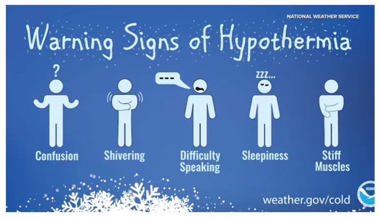
The polar vortex will plunge southward behind the storm front. This will bring temperatures 15 to 25 degrees Celsius below normal levels. Northern Minnesota expects wind chills as low as minus 51 degrees Celsius. High temperatures in some cities will remain in the minus teens. These values will challenge standing calendar-day records.
Residents must take precautions against frostbite and hypothermia. Exposed skin can freeze in less than ten minutes. The extreme cold will persist well into next week. This creates a risk for livestock and unprotected populations. Authorities advise people to remain indoors during the peak cold.
- Wind chill lows: Minus 51 degrees Celsius.
- Temperature deviation: 15 to 25 degrees below average.
- Duration: Persisting through early February.
Uncertainty in Precise Forecast Models
National weather offices continue to monitor the storm’s exact path. Small shifts in the track will change the local impacts. “Confidence in accumulating snow this weekend continues to increase, but there is still a wide range of possible outcomes when it comes to exact amounts and severity of impacts,” the National Weather Service stated. Some models show higher snow totals for the East Coast.
Other simulations suggest the cold air might push the storm further south. This would reduce the impact on the Northeast. However, “Significant and damaging ice accumulations” are likely for the South. Residents should check for frequent updates to the forecast. Weather alerts will change as the system develops.
Infrastructure and Travel Disruptions
The storm will peak on Sunday across the nation. Roughly 55 per cent of the contiguous population will experience precipitation then. Major airports in the path expect flight cancellations. Airlines will likely issue travel waivers for the weekend. Road crews will struggle to keep highways clear.
Snowfall rates might exceed 25 millimetres per hour at times. This intensity makes snow removal very difficult. Power companies are already staging repair crews in the South. They anticipate damage from the forecast ice storm. Residents should prepare emergency kits with food and water.