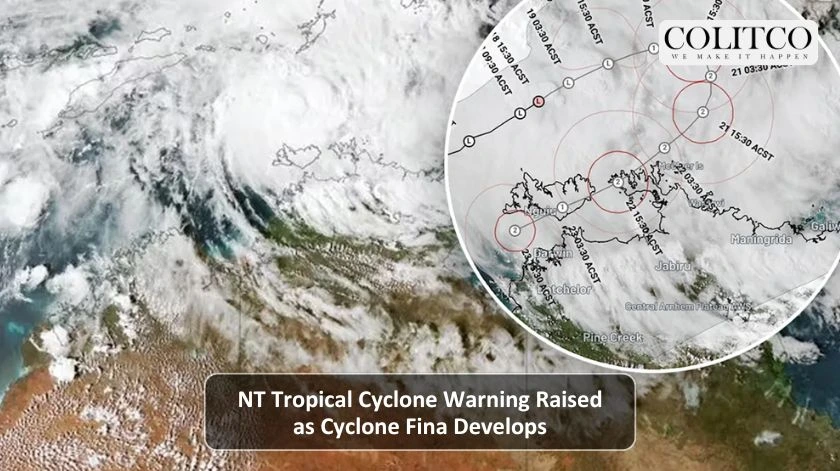
The authorities have given an NT tropical cyclone warning after the North side of Darwin, Cyclone Fina, formed and was rapidly gaining strength. The system is likely to go up to the second category before potentially making landfall later this week. People living in the Northern Territory’s Top End are being told to get ready.
Cyclone Fina strengthens near Darwin, prompting urgent NT preparedness warnings.
What Is the Latest Cyclone Fina Weather Update?
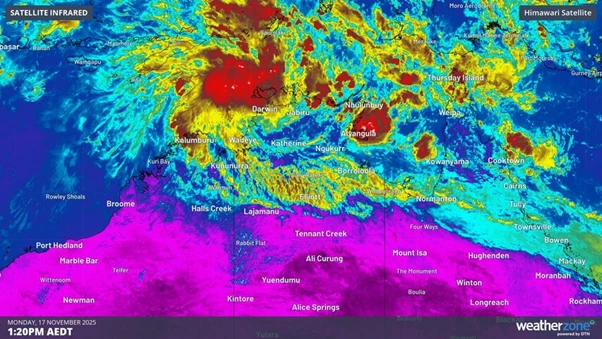
According to the Bureau of Meteorology (BOM), Cyclone Fina is a category one cyclone with wind speeds of about 75 km/h and gusts of 100 km/h. It is slowly moving in an east-north-east direction at about 9 km/h. The projection is that, by the night of Wednesday, the cyclone could be upgraded to category two as it turns southward towards the land.
Why Has the NT Tropical Cyclone Warning Been Issued?
The watch area now consists of the eastern village of Milingimbi, going through the Tiwi Islands, and reaching the western side, where winds of up to 120 km/h are expected by Thursday. Weather models predict that by Thursday afternoon or early Friday, gusts could be up to 135 km/h. Meteorologists say a further intensity is not likely, but they have not excluded the possibility of a transition to category three.
Cyclone watch expands as winds intensify, with possible category three risk.
How Are Authorities Responding to the Threat?
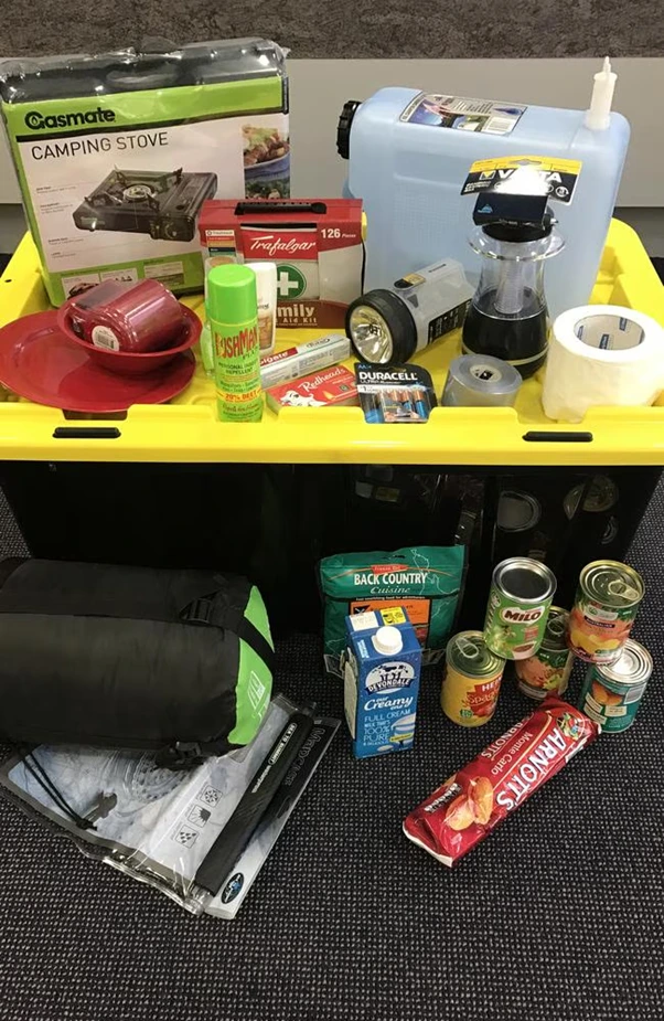
Through emergency services, coordination is taking place in the vulnerable communities that are at risk, like the Tiwi Islands and the remote areas along the main coast. The Territory Emergency Operations Centre has been set up and is ready for a variety of impacts. The residents are being told to complete their emergency plans, stock up with a 72-hour supply kit, and make sure they have a way to communicate with family or friends even if the power goes out or the phone network fails.
What Should Residents Do Now?
The NT tropical cyclone warning is not just a warning, but it is a call to action. Resident…”Emergency shelters and supplies should be checked first. Phone lines should also be kept open in order to receive official updates like BOM bulletins and NT Emergency Service alerts, and unnecessary trips should be avoided as a means of making sure the distinct danger does not get to you.
NT residents must prepare shelters, secure supplies, stay updated, and avoid travel.
What Are the Implications for Cyclone Tracking Across Australia?
Cyclone Fina plays the role of a dreaded harbinger, for indeed it was sternly early in the season and also very quickly to blacken the skies and become a real threat. The incident reactivates the necessity of accurate cyclone tracking Australia-wide. Australia can track even such a small cyclone as Fina, but the reason is that Fina’s small size may allow very quick shifts in intensity, making close monitoring a must. The North of Australia is reliant on accurate predictions and preventive measures as the only defence.
Could Cyclone Fina Be a Record-Early System?
Experts are divided on the issue of Fina’s possible record-breaking landfall time in the Northern Territory; some say she would be the same as past early-season cyclones. The very early season conditions, coupled with the cyclone’s development and sea surface temperature, are the main reasons behind this being such a remarkable case in the first half of the season.
Regional Authorities Ramp Up Their Support On The Ground
As Cyclone Fina approaches the NT coast, the regional authorities are increasing their support on the ground. Emergency teams are being positioned in every at-risk community to strengthen the preparedness activities and to offer assistance to the residents if they need help with securing houses or collecting vital supplies. Furthermore, more resources are being positioned for the purpose of communication, transport, and medical access, guaranteeing that the remote parts of the country will still be supported if the conditions during the NT tropical cyclone warning become worse.
Also Read: Sydney Weather Chaos: Power Outages Worsen Across NSW Amid Bomb Cyclone
FAQs
Q1: What NT tropical cyclone elements express the difference between a watch and a warning of the cyclone?
A watch means that gale-force winds are likely in 24–48 hours; a warning means those winds are forecasted in 24 hours or have already started.
Q2: When will Cyclone Fina probably be at the same location as land?
According to the forecasts, this could be between Friday and Saturday, depending on its direction and speed of getting stronger.
Q3: Can Cyclone Fina be more powerful than Category 2?
Yes, although category two is the most likely outcome, forecasters do not completely discard the category three possible upgrade.
Q4: Which safety precautions should people adopt because of the NT tropical cyclone warning?
First of all, residents have to secure their houses, prepare a 72-hour emergency kit, have a communication plan, and stay updated via official channels.