Damaging Winds, Showers and Coastal Flooding Forecast Across Multiple States
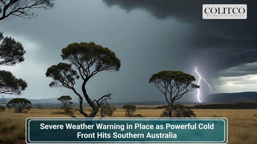
Southern Australia is facing an intense weather event this week as a powerful cold front sweeps across the region, prompting a widespread Severe Weather Warning. The Bureau of Meteorology has flagged damaging winds, possible thunderstorms, alpine snow, raised dust and heavy surf for large parts of Western Australia, South Australia, Victoria, Tasmania and New South Wales.
Weather authorities have urged residents across the impacted regions to stay alert and prepare for dangerous conditions, particularly during the peak period on Tuesday, 8th July.

The situation around Australia, especially focusing on the Southern part of Australia [Windy]
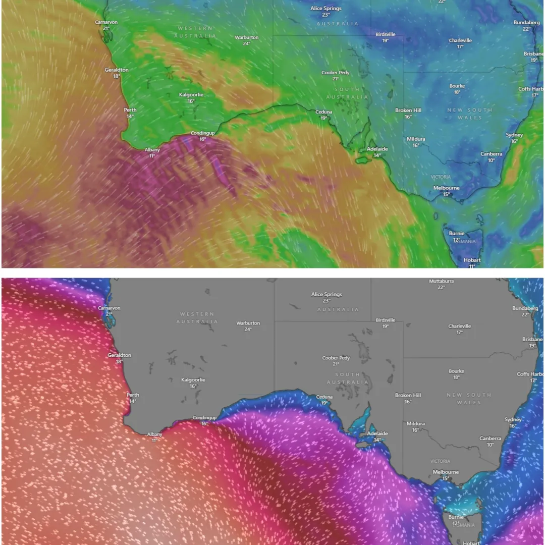
The top image displays strong wind patterns affecting Western Australia, South Australia, and Victoria, while the bottom image highlights large swells along southern coastal regions, with wave heights reaching 5 to 7 metres. [Windy]
Rapidly Moving Cold Front Sparks Urgent Alerts
The cold front made landfall in south-west Western Australia on Monday and is racing eastwards, bringing a wave of destructive weather behind it. The Bureau’s Angus Hines explained the intensity of the system: “It is bringing wet weather, but most importantly it is bringing damaging wind gusts.”
By Monday night, the front had reached the far west of South Australia, and by Tuesday morning it had advanced through Victoria, Tasmania and southern parts of New South Wales. The main threat? Winds exceeding 100 km/h in some areas, along with the possibility of property damage, travel disruptions and hazardous driving conditions.
State-by-State Impact Breakdown
Western Australia
Strong winds hit Perth and surrounding regions early Monday. Gusts of 90–100 km/h were recorded from Perth to Esperance. The Bureau issued a Severe Weather Warning covering cities including Albany, Bunbury, Katanning, and Mandurah. By Monday night, most of the front had passed, though lingering wind and rain continued along the coast into Tuesday.
Perth residents also experienced flooding, with The Oarhouse café in Bayswater posting images of the Swan River spilling onto nearby walkways and lawns. “It’s gone up to our deck but hasn’t reached inside the café yet,” said the owner. The business has sandbags and tarps ready if conditions worsen.
South Australia
The front reached South Australia overnight, bringing powerful winds to the Mount Lofty Ranges, Flinders Ranges, and coastal regions. While Adelaide itself escaped a direct warning, nearby areas braced for gusts strong enough to knock over fences, bins, and even roofing panels.
The Bureau warned of rain between 10 and 25mm for many locations, with the limestone coast in the far south-east forecast to receive more than 50mm. Residents were advised to avoid outdoor travel during peak gust periods and to secure loose items.
Victoria
Victoria bore the brunt of the storm on Tuesday, with wind warnings issued for the Grampians, Central Ranges, and northeast alps. Even the Mornington Peninsula was placed under alert.
Melbourne endured a wild day of gusty winds, heavy showers and plummeting temperatures. The city peaked at just 14 degrees. Alpine regions saw snowfalls, while central and eastern districts were lashed by wind-driven rain.
Tasmania
The cold front hit Tasmania later in the day, but with similar intensity. Gusty winds and a band of rain moved across the state, with western and northern areas most affected. Hobart recorded showers and a high of 14 degrees. Coastal erosion and minor inundation risks were flagged due to high tides and strong swells.
New South Wales
New South Wales is the last to be impacted, with damaging winds forecast for Tuesday evening through to Wednesday morning. The Snowy Mountains, Central Tablelands and inland Hunter region are expected to bear the brunt. Gusts of up to 100 km/h could lead to travel delays, falling tree limbs and dangerous conditions on mountain passes.
Sydney may escape the worst, but residents should still expect strong breezes and cooler temperatures, with a forecast high of 19 degrees.
Watch the full update here:
Coastal Erosion and Dangerous Surf
Alongside the strong winds, the Bureau has warned of large and hazardous surf conditions. Waves of 5 to 7 metres are forecast from the WA coast to southern Victoria, with potential for significant coastal erosion.
Angus Hines added that some low-lying coastal areas could see seawater inundation during high tides: “That includes walkways, bike paths, car parks and potentially a few roads and properties.”
Also Read: NAIDOC Week 2025 Celebrates Strength, Vision and Legacy: Full List of Winners
Precautionary Measures Urged
Emergency services and weather experts are advising Australians in affected areas to take the following precautions:
- Tie down or pack away loose outdoor furniture and items such as trampolines and bins
- Prepare an emergency kit with a torch, batteries, first aid supplies and a portable radio
- Avoid unnecessary travel during peak wind periods, especially over mountain passes
- Stay updated with the latest forecasts and alerts via the Bureau’s website or app
The Bureau confirmed that Severe Weather Warnings will be updated regularly as the system continues its rapid movement across the country.
Elsewhere in the Country
While the southern states grapple with stormy conditions, Queensland and the Northern Territory remain dry and sunny under high pressure. Brisbane is enjoying a sunny 22 degrees, while Darwin reaches 32 with clear skies. Morning frost was reported in southern inland Queensland, but warm afternoon temperatures are providing a reprieve.
A Wild Week Ahead
As this powerful system moves through, the weather pattern remains unstable. More warnings could follow as the cold front interacts with local terrain and pressure systems. Australians are advised to remain vigilant.
Severe weather events like this highlight the importance of preparedness. As the Bureau continues to monitor the situation, the message is clear: stay safe, stay informed, and take the Severe Weather Warning seriously.