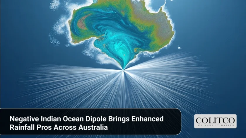
Wetter Weather to be Felt in Central and Eastern Australia
Australia is set to see its first negative Indian Ocean Dipole (IOD) in three years, with an ensuing higher than normal prospect of rain for the period August to November. The Bureau of Meteorology (BOM) forecasted a 70 to 80 per cent chance of above-average rain across most of the eastern two-thirds of the country.
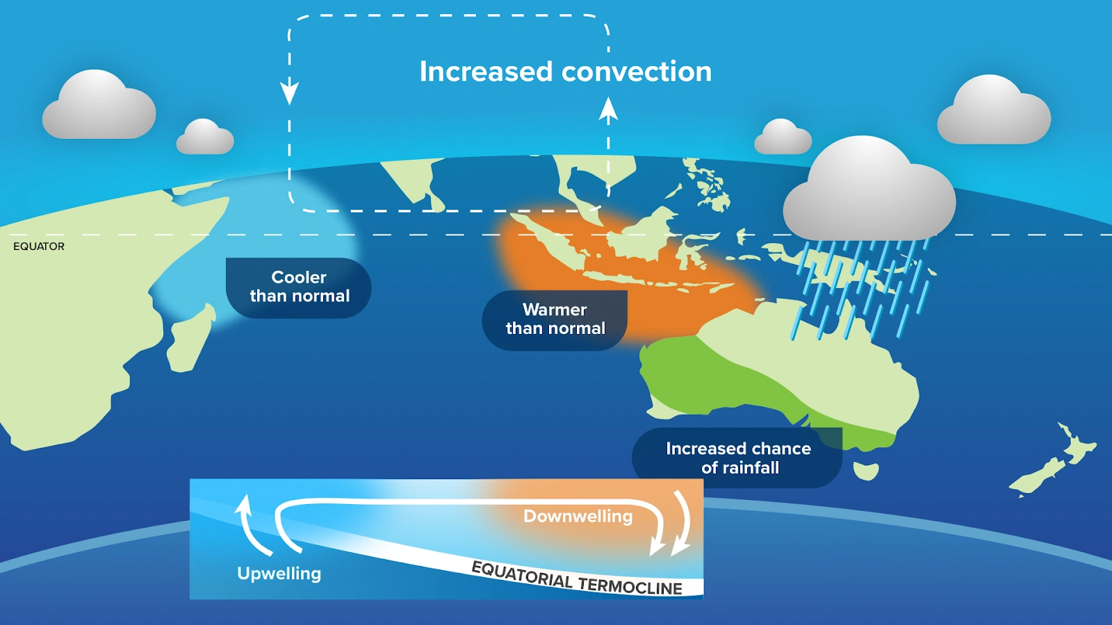
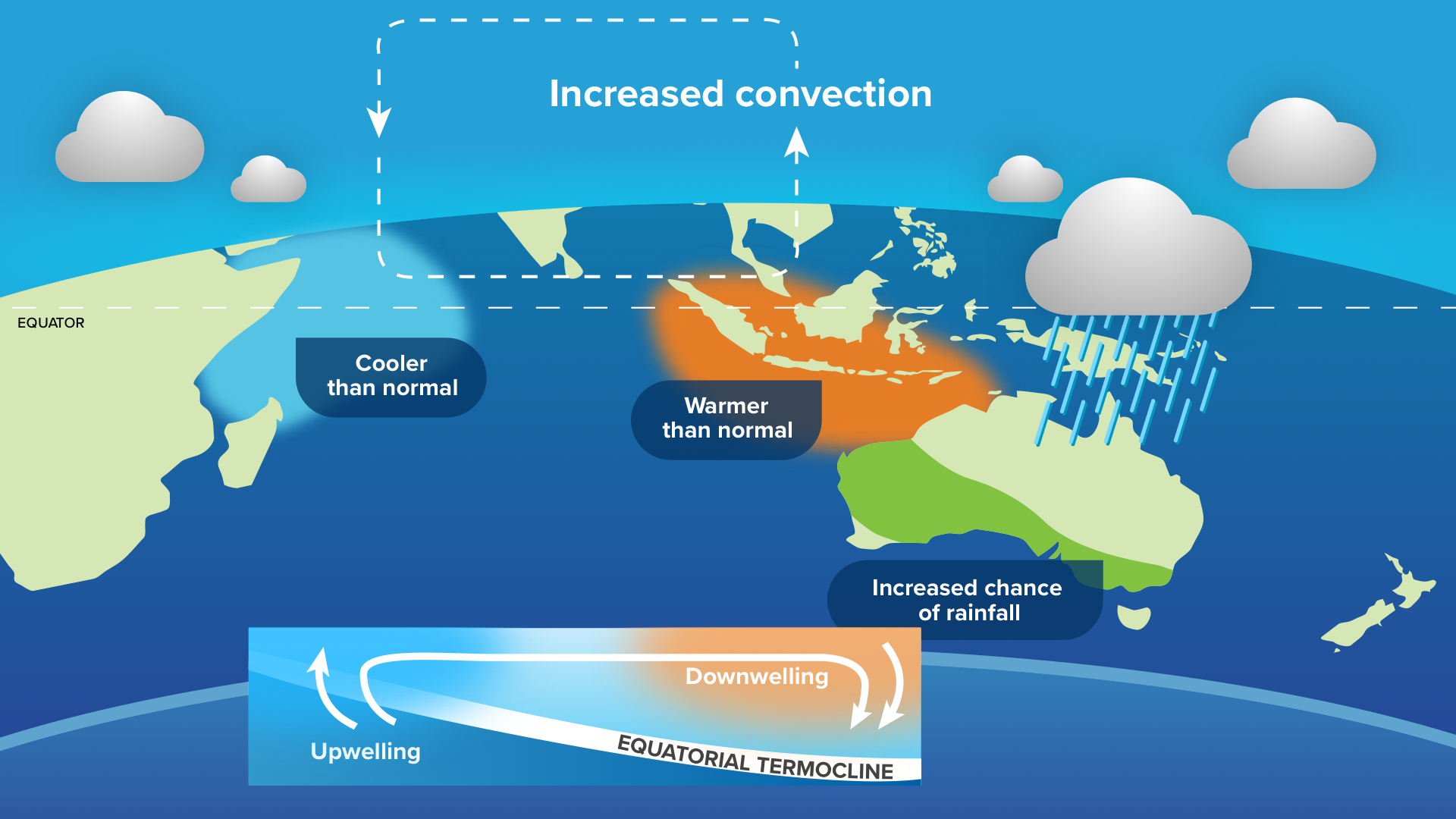
Negative IOD boosts rainfall over Australia
A negative interview of the seas is when warmer water builds closer to Indonesia and cooler water forms off the Horn of Africa. It supports moist airflow into Australia, contributing to cloudiness and rain. Such events in 2010, 2016, 2021, and 2022 led to some of the nation’s wettest times.
Ocean Temperatures Indicate Extended Wet Phase
The latest readings show the IOD index standing at -0.6°C for two consecutive weeks, beneath the -0.4°C reading that needs to be achieved for a warning of a negative phase. It needs to last for at least another six weeks to be included for the year.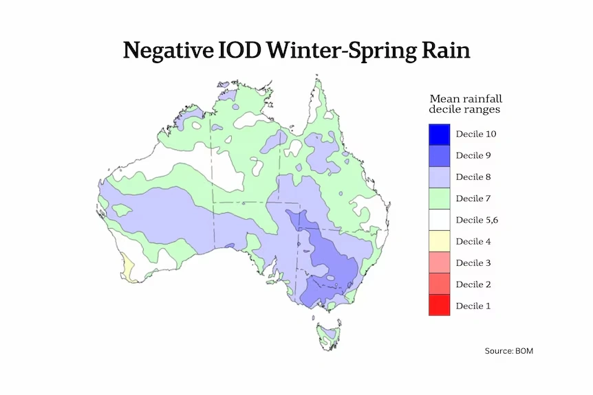
Indian Ocean temperature anomalies showing negative IOD
BOM modeling forecasts the index will peak at around 1°C in September before dropping back to neutral in December. That phase is expected to influence rainfall patterns through to spring. Negative IODs usually develop in winter, rapidly intensify, and collapse early in summer.
Rainfall Patterns Associated with Negative IOD
Historical data show that national spring rainfall is 36 percent higher in negative IOD years compared to neutral years. The boosts are largest in the inland southeastern regions, where amounts often place in the upper 20 percent of all on record years.
The phenomenon will try to deliver more rain to central and eastern Australia. But in the absence of an equal Pacific La Niña, rain will not be as widespread as during previous wet years.
Temperature Outlook for Spring
Although the warming of all seasons has resulted from climate change, prolonged spells of rain have a cooling influence on daytime temperatures in the form of prolonged cloud cover. BOM seasonal forecast reports the central and eastern Australia regions forecast to achieve below-median maxima between August and November.
Overnight temperatures are forecast to be above average over the majority of areas, and unusually warm nights are forecast for the eastern part of the country. Warming surrounding waters will also provide additional moisture into weather systems.
Regional Forecast Variations
Eastern Queensland, New South Wales, southeastern South Australia, and northern Victoria have a greater likelihood of seeing above-average enhanced rainfall in the upper 20 percent of records for September-November.
Western parts of Western Australia and southern Tasmania will, however, face below-average rainfall over the same period. This is typical negative IOD behavior, where precipitating systems favor eastern and southern regions.
Drought Persists in Some States
Despite the recent rains, drought still remains a problem in the areas of South Australia, Victoria, Tasmania, and Western Australia. The areas have some of the lowest multi-year rainfall totals ever documented, and more frequent steady rain is needed to improve matters.
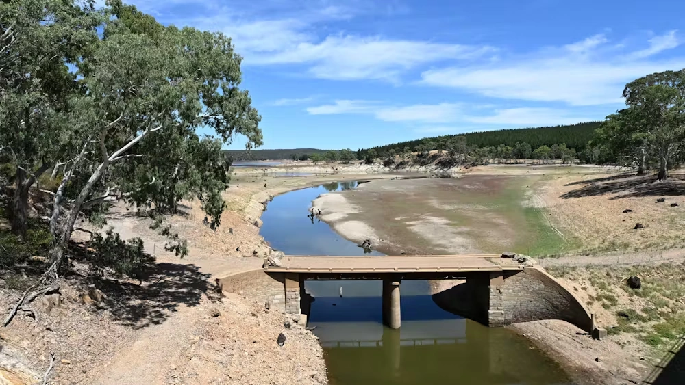
Low water levels in South Australia
There are many other examples like that. The South Para Reservoir in South Australia, for instance. While the forecast is driving the recovery, the recovery would depend on normal rain over the coming months.
Also Read: Israeli Air Strike Kills Five Al Jazeera Journalists in Gaza City Attack Near Al-Shifa Hospital
Final Thoughts
The developing adverse Indian Ocean Dipole will affect Australia’s climate for the remainder of winter and large parts of spring. Above-average rain is highly likely in central and eastern parts, reduced daytime temperatures in portions of the interior, and unaltered warm nights.
While not all the states will be wetter, this ocean-influenced regime can potentially bring a massive seasonal shift to previously drought-stricken regions. BOM will also monitor ocean and atmospheric conditions for additional explanation in the weeks ahead.


