
Guyana is moving towards offshore oil exploration using new government-led 3D marine seismic surveys. These surveys cover deepwater blocks the government left unsold in its initial auction.
The data will anchor the initial petroleum repository in the country. It will further consolidate local control over geological intelligence. This intelligence previously resided abroad. The change is expected to boost investment confidence.
Officials believe it will improve preparation for future licensing rounds. It will also support long-term upstream development over offshore acreage.

A seismic survey ship is carrying out 3D mapping in the offshore blocks of Guyana. [Facebook]
Why Is Guyana’s Offshore Oil Exploration Accelerating Now?
In 2023, the government first flagged plans for a national data system. Officials recognised that overseas storage caused access delays and strategic drawbacks. These issues limited timely decision-making and reduced competitiveness.
During the 2026 Budget presentation, Senior Minister Dr Ashni Singh confirmed the proposal. He said a dedicated platform would enhance data management. It would simplify exploration decisions for operators and regulators.
The system would also help maintain a competitive advantage. More companies are assessing frontier deepwater prospects. Regional activity is increasing steadily.
Government Plans A National Petroleum Data Repository
The government is contracting two seismic acquisition firms. They will conduct the first government-led multi-client 3D seismic survey.
The survey will cover both licensed and unlicensed offshore acreage. The project will facilitate the storage of all petroleum information domestically.
It will also improve local data management systems. The information will be housed in a planned Guyana petroleum data centre.
The centre will provide a permanent archive of petroleum data. It will store high-resolution subsurface datasets. These datasets will support exploration planning across the area.
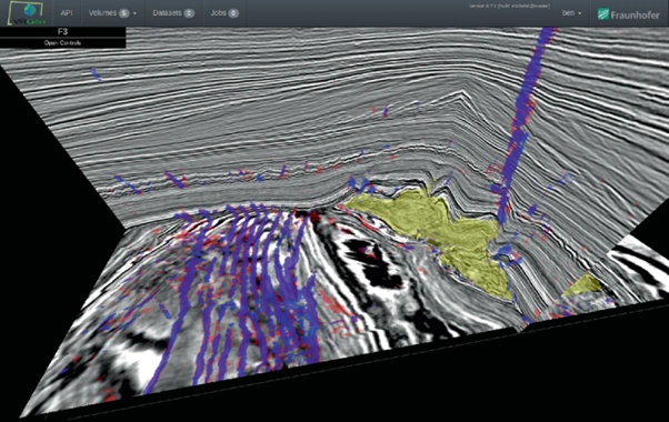
Seismic data Digital visualisation with a central petroleum data centre feeding. [Springer Link]
How Will The Guyana Petroleum Data Centre Improve Licensing?
Potential bidders will gain a better geological understanding. They will face less uncertainty during the initial exploration phase. Access to detailed seismic coverage will become centralised.
This will enable the government to design future auctions with favourable terms. It may also support higher pricing outcomes.
Enhanced transparency is likely to attract greater international participation. It could strengthen the government’s bargaining position. Companies may feel more confident before investing in drilling infrastructure.
New Agreements And Seismic Work Expand Activity
In the last quarter of 2025, two new Petroleum Agreements were signed. They followed consultations linked to the 2022/2023 licensing round. Discussions are continuing this year under an updated fiscal and contractual structure.
The operator of Block S4 is preparing for fresh seismic activity. This work forms part of initial exploration measures. These steps align with Guyana’s overall oil exploration efforts. The aim is to unlock new offshore potential.
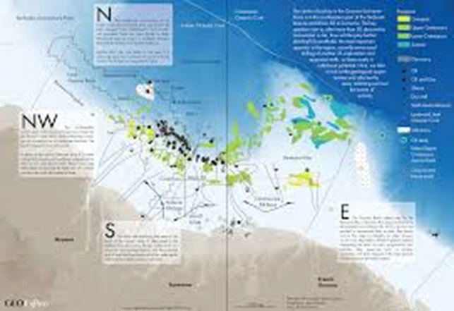
Map of Offshore Guyana showing licensed/unlicensed deepwater blocks. [GeoExpro]
What Could Future Auctions Mean For Investors?
Authorities plan to hold further international licence rounds after the new seismic datasets become available. The offerings will be backed by improved subsurface data quality. This will aid the assessment of exploration prospects. Several companies are already planning to re-offer acreage. Latitude Energy Inc. is among those preparing proposals.
The company has applied for environmental approval. It aims to acquire and process 3D towed streamer seismic information. The work will cover Blocks D1, D2 and D3. These blocks sit in the northeastern offshore maritime area.
Guyana is the largest per capita oil producer in the world. The country deliberately avoided providing seismic data in its initial round. Leaders now believe full coverage will yield higher bids. They expect improved resource estimates from better datasets.
They also aim to sustain long-term investor interest. This structural improvement could strengthen competitiveness. It may position Guyana among South America’s most data-ready exploration markets.
Also Read: Worley Takes Command Of High-Stakes Offshore Engineering And Delivery
FAQs
Q1: What Is The Purpose Of The New Seismic Surveys?
A1: They will collect detailed subsurface data to support exploration and future licensing rounds.
Q2: What Is The Guyana Petroleum Data Centre?
A2: It is a national repository to store and manage petroleum data locally.
Q3: How Many New Agreements Were Signed Recently?
A3: Two new Petroleum Agreements were signed in the final quarter of 2025.
Q4: Which Blocks May See New Seismic Work?
A4: Latitude Energy targets Blocks D1, D2 and D3 for 3D towed streamer surveys.