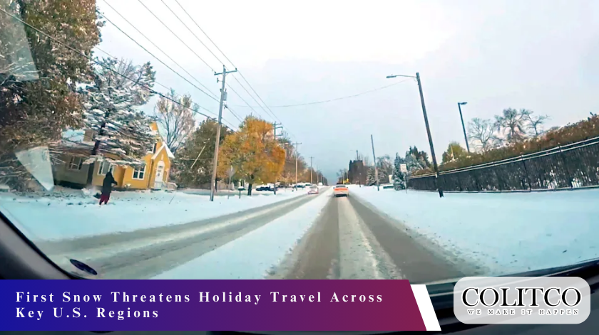
First Snow Arrives in the Twin Cities
First snow is expected to hit the Twin Cities on Tuesday night as holiday travel intensifies. A broad weather system is moving into the region with rain forecast to change into snow during the evening hours. Forecast models show a rapid temperature drop, which may create a challenging start to one of the busiest travel periods of the year.
Snow begins to settle on major Twin Cities roads as temperatures fall sharply
The National Weather Service expanded a winter storm warning for the metro and surrounding areas. Strong winds and temperatures falling into the lower 20s (°F) could lead to icy surfaces, especially on untreated roads. Motorists are expected to face difficult conditions as the shift from rain to snow increases the risk of sudden freezing.
Storm Timing and Expected Snowfall
The storm is forecast to arrive in two phases. Rain is likely during the late afternoon before colder air pushes into the region and turns the precipitation into steady snow. Forecasters expect accumulating snow to begin during the night and continue into Wednesday morning.
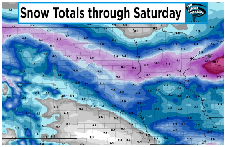
Forecast models show a strong snow band moving into Minnesota overnight
Snowfall projections indicate that the Twin Cities may receive between 3 and 5 inches. Northern areas, including the Brainerd Lakes region and communities near the Arrowhead, could record totals closer to 8 inches. The combination of colder air and strong wind gusts may cause additional snow to drift across open roadways.
Cold Pattern Extends Across the United States
The arrival of the storm in Minnesota forms part of a wider pattern of cold air moving into the northern and central United States. This shift follows a period of unusually mild weather, with temperatures in the Twin Cities recently reaching the mid-50s (°F). The sudden change is expected to influence travel across several states during the week.
Further east, colder air passing over the Great Lakes may lead to lake-effect snow. Meteorologists warn of the possibility of strong snow bands developing over northern Michigan, Wisconsin, and portions of New York and Ohio. These bands may create abrupt drops in visibility and cause abrupt travel delays.
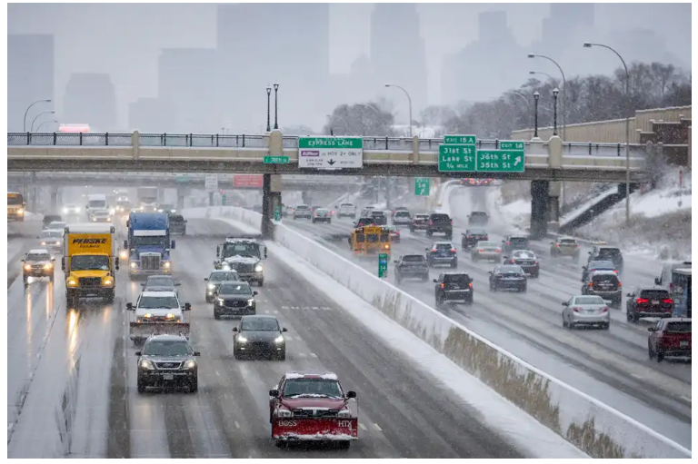
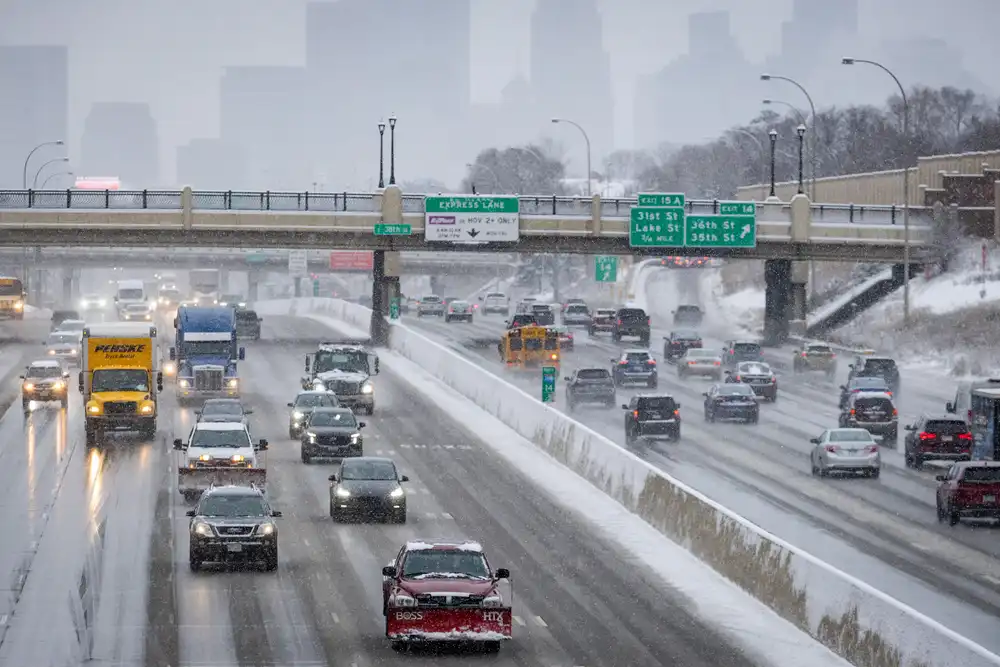
Travel Concerns on Major Highways
Road conditions across the Northern Plains are expected to deteriorate as the storm progresses. Wind-driven snow may reduce visibility on key highways, including Interstate 94 northwest of Minneapolis. Road authorities warn that drifting could occur in exposed areas, making driving more difficult.
Drivers brace for reduced visibility and icy roads on major Midwest highways
With recent warm weather leaving roads mostly untreated, the shift in temperatures may cause rapid ice formation. Even light snowfall may produce slick surfaces when combined with the expected overnight freeze. Drivers are encouraged to prepare for slow travel and changing conditions throughout the night and into Wednesday.
Air Travel Challenges and Flight Delays
Air travel could also face delays as the storm spreads across the Midwest. Major airports in Minneapolis, Chicago and other regional hubs may experience disruptions due to reduced visibility, strong winds, and rapidly changing weather conditions. Snow removal teams are expected to be active through the night as the storm evolves.
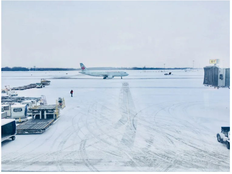
Airports prepare for delays as snow and strong winds reach travel hubs
On the East Coast, rain and gusty winds may add further pressure to already crowded airports. Weather systems moving across the region could delay departures and arrivals, especially during peak travel windows. Flight authorities advise passengers to monitor their flight status frequently, as conditions may change quickly.
Widespread Weather Risks During the Holiday Period
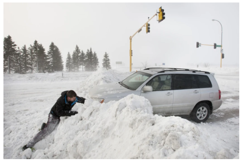
Forecasts show that this storm is part of a broader weather pattern affecting the central and eastern United States. Winter Storm Watches and Warnings are in place for Minnesota, Wisconsin and parts of the Upper Midwest. Meteorologists expect some areas to experience wind gusts of up to 40 mph, which may reduce visibility and move snow across roads.
Lake-effect snow near the Great Lakes may linger through the week, creating additional challenges for communities and travellers. The combination of snow, rain and strong winds may influence travel plans for millions of people throughout the extended holiday period. Officials across affected regions continue to monitor conditions and update advisories.
Advice for Travellers on the Road and in the Air
Authorities recommend that travellers heading out by road leave extra time and reduce speed as conditions worsen. Drivers are encouraged to check updated road advisories and consider alternate routes if heavy snow develops on primary highways. Those travelling at night are urged to use caution because roads may freeze with little warning.
Air travellers are advised to arrive early at airports due to the increased likelihood of delays. Weather conditions may cause slower boarding, runway clearance delays and longer wait times at security checkpoints. Monitoring airline updates remains essential as schedules may be adjusted throughout the storm.
Also Read: Tropical Cyclone Fina Hits Berkeley River Lodge in Western Australia
Final Thoughts
The first snow of the season is set to arrive at a challenging moment for millions of travellers. The combination of cold air, steady snow, strong winds and shifting conditions across the Midwest and Great Lakes regions may disrupt holiday plans on both roads and in the air. Travellers are encouraged to stay informed, allow extra time and prepare for changing weather as the storm evolves.


