
Widespread Rainfall Stretches Across Australia
A vast rainband has swept across Australia, marking the most widespread rainfall event in years. The system, extending nearly 3,000 kilometres, stretches from tropical Queensland to Tasmania and is delivering heavy alpine snow.
Rain began on Wednesday and Thursday as a strong cold front surged across Western Australia. Perth recorded over 50 millimetres, and the front triggered a destructive tornado. The cold front’s unusual northward movement allowed tropical moisture to feed into the system, essential for inland rain development. A low-pressure system formed near the WA south coast, further intensifying rainfall.
Today’s water vapour satellite imagery shows areas with large amounts of moisture across parts of central & eastern #Australia – green and blue colours. This moisture is fuelling #rain across the country today.
Latest forecasts & warnings: https://t.co/jlOoTZLz8d pic.twitter.com/E4Y8Wx4K0O
— Bureau of Meteorology, Australia (@BOM_au) July 25, 2025
South Australian Towns Record Heaviest Rain Since 2023
Clare in South Australia’s Mid North received over 25mm, marking its highest total since late 2023. Mildura in the parched Mallee picked up 10mm by sunset Friday, its heaviest 2025 fall to date.
As the front progressed east, the rainband reached New South Wales, Queensland, and Tasmania. A trailing low along the southern coast is extending showers across South region and Victoria, expected to last another 48 hours.
By late Monday, southern Murray Basin and key South farming zones will likely receive 15 to 30mm, including previous falls. The low is also causing strong winds and heavy snow across the Alps.
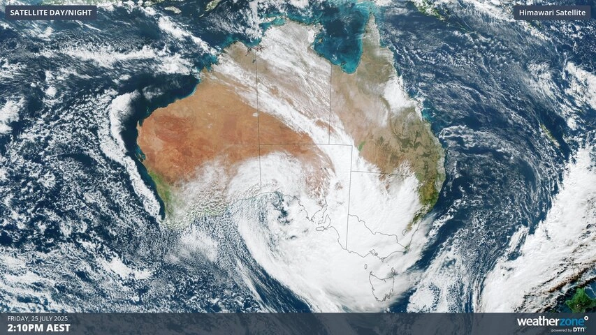
Visible satellite image showing cloud over Australia on Friday
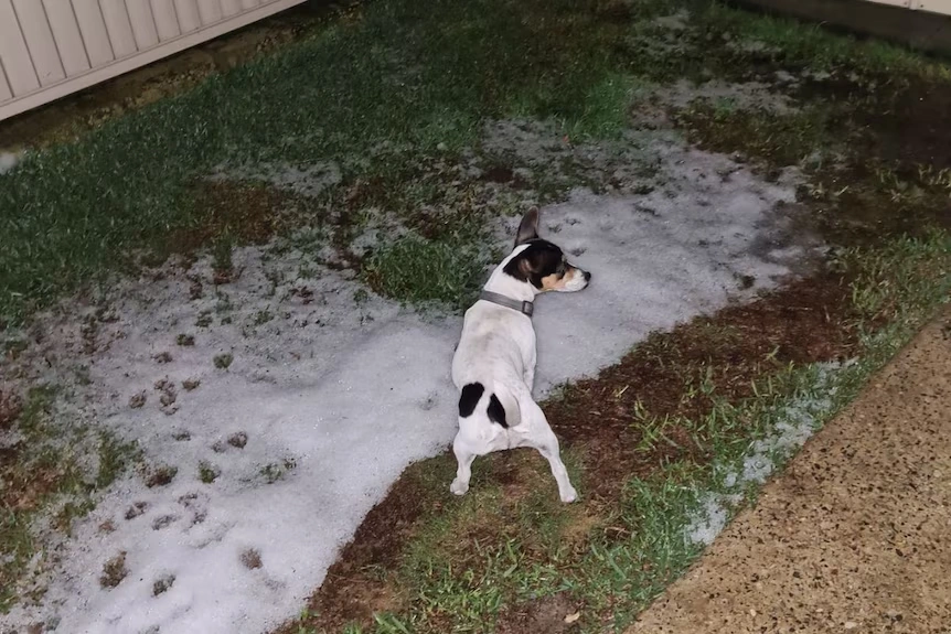
Fresh Snow Blankets Alpine Regions
Snowfall is intensifying with 50 centimetres expected across higher alpine slopes over the next three days. The snow and wind conditions will persist until late Monday when the low exits into the Southern Ocean. This snowfall adds to an already improved ski season following two low-snow years.
Snowfall is intensifying across Western Australia
Follow-Up System Set To Arrive Early Week
A second weather system is forecast between Sunday and Thursday, enhancing hopes for sustained drought recovery. A vigorous cold front, the third in a week, will reach Western Australia on Sunday. Like its predecessor, this front will trigger another low near the southern coast.
The upcoming low will tap into a smaller tropical moisture source, reducing rainfall intensity. Nonetheless, it is expected to produce widespread showers across WA from Sunday, western SA on Monday, and into south-east states from Tuesday.
Most Significant Rainfall Week In Two Years
Combined weekly totals should reach 25 to 50mm across southern Australia, marking the most extensive rainfall week since 2023. Alpine regions may also receive additional snow as another polar air mass lowers the snowline to around 1,000 metres.
National Weather Forecast: Cold, wet and windy weekend for south-east Aus, dry and sunny elsewhere.
Video current: 2:00pm AEST 25 July 2025
Latest forecasts and warnings: https://t.co/4W35o8iFmh or the BOM Weather app. pic.twitter.com/g1q26YI7po
— Bureau of Meteorology, Australia (@BOM_au) July 25, 2025
Bureau Outlook Signals Wetter Spring
Long-term forecasts by the Bureau of Meteorology (BOM) suggest a shift towards wetter conditions. The BOM’s ACCESS–S model shows up to an 80 per cent chance of above-median rainfall across eastern Australia from August to October.
Multiple global models support this outlook. An ensemble of nine models indicates a 70 to 90 per cent likelihood of above-average rainfall across central and eastern regions.
Also Read: Adam Sandler Tees Off Again as ‘Happy Gilmore 2’ Swings Big with Stars and Nostalgia
Ocean Signals Support Moisture Trend
Ocean temperature patterns offer clues behind the models’ forecasts. Long-range projections hint at developing weak La Niña and negative Indian Ocean Dipole signals. These phenomena typically support wetter Australian conditions.
However, BOM cautioned against relying solely on these drivers, as no clear trends have yet emerged. The agency noted that forecasts should incorporate current rainfall data alongside seasonal outlooks.
Southern Drought May Be Easing
Meteorological indicators suggest the end of southern Australia’s record drought may be near. Sustained wet months are needed for complete recovery, but consistent weekly systems and supportive modelling mark a promising turn.
With additional systems forecast in the near term and long-range models indicating continued rainfall, conditions may continue to favour drought relief.
Southern Australia could be entering a sustained wet period, marking a significant shift from the dry conditions experienced since mid-2023.