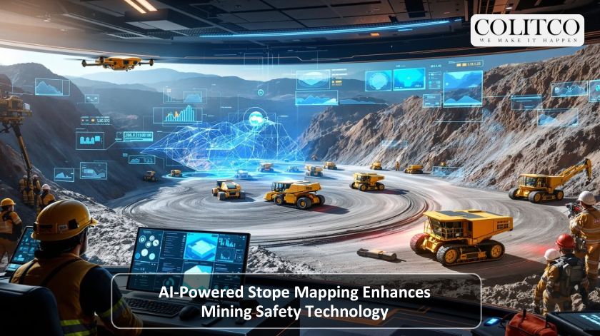
Autonomous walking and underground mapping seemed like a dream of the future. To this day, it is revolutionising the mining safety technology world, reducing risks, and delivering faster results for mine planning. The Emesent’s Hovermap system, which has undergone an upgrade, is the invention behind this change, and it is setting the new standard for underground mines in terms of data gathering and analysis.
Autonomous walking and mapping revolutionise mining safety with faster results
What Is AI Stope Mapping And How Does It Work?
The AI stope mapping is based on LiDAR sensors, combined with SLAM-based geolocation and advanced autonomy software. The high-tech solution creates a thorough 3D image of stopes and tunnels, and thereby a detailed model of areas that were previously unreachable. The autonomy engine of Hovermap integrates in real-time: object avoiding, dust filtering, and plug-and-play mission planning all of which contribute to generatina precise spatial data.
In contrast to the manual cavity monitoring systems (CMS), Hovermap does not require a human operator to be present in the dangerous area at all times. The total operation—from take-off to landing—can be carried out on a tablet, thus keeping the operators safe and remote. The live point cloud streaming provides real-time underground visibility, while the onboard processing extracts instant data insights that are ready for third-party analysis.
Why Is It Transforming Mining Safety?
In the case of traditional CMS tools, they are quite large and may pose risks to personnel. However, Emesent’s Hovermap is a game-changer as it allows the drone to fly beyond the visual line of sight and communications range, which renders it very useful for surveying areas that are not safe or stable.
The breakthrough indicates how the mining safety technology is capable of transporting workers away from the dangerous zones. The Hovermap technology takes advantage of autonomous navigation to avoid manual surveys in the areas where rockfalls, collapses, or gas exposure are likely to occur. The technology not only improves safety compliance but also guarantees that production does not stop, even in the most extreme conditions.
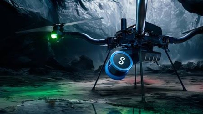
Emesent’s Hovermap outperforms traditional CMS tools, enabling safer remote surveying
How Flexible Is The Hovermap Platform?
One of the major benefits of Hovermap is its adaptability to various deployment modes. The system is initially meant for use with drones, but it can be easily shifted to vehicles, robots, backpacks or handheld scanners. This ensures that there is no interruption in the workflow in terms of scanning and mission types.
Hovermap, which supports more than 20 use cases, is involved in fall-of-ground inspections, convergence monitoring and environmental analysis. The flexibility of the technology helps mining companies to collect data across different locations in a standardised manner, hence ensuring that the safety and operational standards are consistent.
Emesent Leads In AI Mining Applications
Emesent, an Australian company that is the creator of Hovermap, has taken the lead in using AI in the worldwide mining industry. The company’s focus on automation is a reflection of the mining sector’s gradual movement to digital transformation. The combination of SLAM algorithms and continuous learning models in Hovermap will make sure that the quality of data will only get better as time goes on.
Plus, this feature is not limited only to stope mapping. Emesent technology is already part of the process for shaft monitoring, tunnel analysis, and volumetric measurements. The engineers can not only monitor mine sites but can also make decisions rapidly by getting the instantly transferred data and visualising it with the cloud.
What Are The Benefits For Mine Operators?
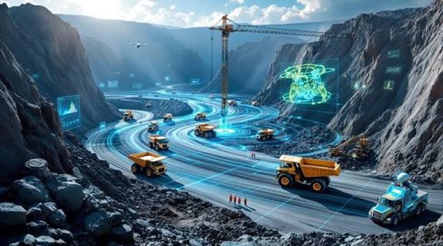
The AI mapping technology has a variety of advantages over conventional ones. The survey speed has significantly increased, and the surveyors are getting not only the point clouds but also the right ones that are very dense and accurate, besides the planning being done accordingly with no delay. The whole process leads to being able to mine more ore, less dilution, and better ground support design.
With its associated work flow, the entire system will have no or very short downtimes, the teams will be communicating more efficiently, and the body responsible for maintenance will be getting their reports proactively rather than reactively. For the investors and the top management people, the reasoning based on financial grounds is quite obvious—less waiting period, lower risks in terms of insurance, and tangible ROI via safer operations and quicker data turnaround.
On top of that, Hovermap’s independence is giving mine operators the chance to make the most of their ventilation systems, thereby getting the least amount of energy used, and emission from operations kept at a low level as part of their sustainability targets. The technology fits with the global ESG reporting standards and thus becomes a stronghold for companies to keep up their environmental and safety credentials in the long run.

AI mapping boosts survey speed, accuracy, and efficiency, enhancing overall mining outcomes
What Lies Ahead For Mining Safety Technology?
The future of AI stope mapping will probably use deeper machine learning insights. As AI models progress, they will eventually spot instabilities on their own, thereby leading the engineers to the mitigation strategies that they can carry out proactively. The ongoing developments at Emesent indicate that complete “zero-entry” mining operations—where no humans are present in the danger zones—are now being realized.
The integration of data from different AI mining applications will be the next big step. Connecting stope mapping with scheduling, ventilation, and resource modelling will result in the creation of a digital twin of the underground operations. This transition can re-categorize not only the safety of mines but also the whole process of planning and operating the assets of global mining companies.
Also Read: Pink Mining Truck Rolls Out to Raise Awareness for Breast Cancer Patients
FAQs
Q1: How does AI stope mapping improve safety underground?
It completely removes the risks to workers’ safety, who would otherwise be entering unstable stopes, through the use of autonomous drones and LIDAR mapping.
Q2: Can Hovermap operate without human supervision?
Yes, it is capable of flying fully autonomous—from take-off to landing—controlled remotely via a tablet.
Q3: Are there any other industries apart from mining that can benefit from this technology?
Apart from mining, Hovermap is also beneficial in construction, tunnelling, and energy infrastructure, and disaster response.
Q4: How soon can mines expect to see a return on their investment from Hovermap?
Most operators experience a return within the first year, mainly due to the combined effect of reduced downtime and increased safety.