Mount Hotham got 77 centimetres of fresh powder when there was an all-night blizzard. In Mount Buller, 82 centimetres of snow fell as the weather system hit Victoria. Bureau of Meteorology forecaster Jonathan How confirmed ski resorts experienced some of the season’s most significant falls.
The weather system brought snowfall to NSW ski resorts and the Northern and Central tablelands on Saturday morning. Orange recorded up to 10 centimetres of snow while Alpine regions saw about 40 centimetres accumulate.
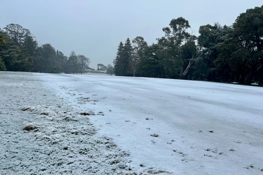
The fairway at Duntryleague Golf Course in Orange covered in white
Destructive Winds Cause Widespread Damage
The winds persisted up to 119 kilometres an hour at the Wilsons Promontory National Park. Powerful winds also beat St Kilda, Gabe and Hogan Islands on Friday and Saturday. Friday afternoon, Mount Hotham delivered 128 kilometres per hour of wind. The same period saw wind gusts of 124 kilometres per hour experienced in Mount Buller.
“We did see trees down, damage to property and quite a few requests for assistance,” How said.
Victoria reported thousands of power outages and emergency service calls. The State Emergency Service responded to 800 calls for help as winds brought down trees across the West Barwon region.
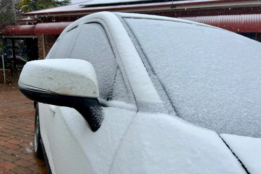
Residents in Orange woke to find their cars covered in snow
Emergency Services Respond to Crisis Calls
NSW State Emergency Services responded to 233 calls for help. Most requests involved trees and large branches falling onto homes and blocking roads. Strong wind gusts wreaked havoc across much of the eastern part of the state.
The Bureau of Meteorology issued severe weather warnings for parts of NSW. A strong cold front continues bringing damaging winds through the Great Dividing Range and Illawarra region.
Snow Reaches Unusual Locations
The Antarctic air mass brought snow to areas that rarely experience winter weather. Flurries fell along the Macedon Ranges before strong winds swept them away. Snow dusted the Blue Mountains west of Sydney in the early hours of Saturday morning.
Mount Victoria, 1,043 metres above sea level, received a light covering across rooftops and branches. At Blackheath, 1,066 metres above sea level, flakes fell in windy streets as the sun came up.
A temperature of -0.1 degrees Celsius was recorded at Mount Boyce weather station at 6 am. The apparent temperature, including wind chill and humidity, was -9.3 degrees Celsius.
Multiple States Experience Rare Weather Event
The cold gush of air also hit those Australians residing in Victoria, South Australia, NSW, the ACT and Tasmania. Friday and Saturday have seen the coldest air in South Australia pass in the early hours. In the Southern Flinders Rangers and the Mount Lofty Ranges, there was falling of snow above 800 metres and above 700 metres, respectively.
BOM meteorologist Miriam Bradbury described the Antarctic system, which created snowfall in the southern states. That will pile snow upon most of our places, but will also be snow upon some places that do not frequently have it, she said.
As low as 600 metres above sea level, it was snowing in Tasmania. Part of Namadgi National Park in the ACT was covered in white all day Saturday.
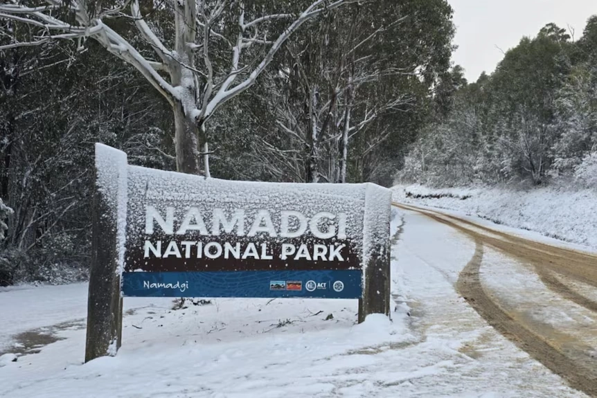
Namadgi National Park covered in snow
Agricultural Impact and Benefits
People in the central west, Oberon and Crookwell, woke up to find their properties covered with blankets of white. Orange had a major snowfall in four years and this affected the transport and local roads.
Roads suffered from several centimetres of snowfall, including routes up Mount Canobolas, which authorities closed for safety reasons.
Cool-climate vignerons near Orange welcomed the conditions that left vineyards covered in snow. Emily Swift, who owns a winery in Orange, described waking up to snow everywhere as beautiful.
“We love the snow on our vines because the snow has a lot of nutrients in it,” Swift said. “The fact the snow melts slowly means those beautiful nutrients are soaked into the soil and the vines love it.”
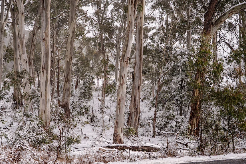
Gum trees covered in snow at Shooters Hill
Weather Warnings Continue
“It is very windy, there is still a warning for eastern parts of NSW and cold condition right across the southeast of the country,” How said.
Melbourne and the state’s east face severe wind warnings for the remainder of Saturday. Damaging winds will affect Seymour, Geelong, Melbourne, Wonthaggi, Orbost and Frankston.
The Illawarra region expects winds up to 90 kilometres per hour. The wild weather will likely hit the Hunter, Mid North Coast and Northern Tablelands.
ACT residents received severe weather warnings with reports of snow within 35 kilometres of the capital city.
Also Read: Sony’s PS6 Handheld Could Reshape Portable Gaming with Nintendo Switch-Style Docking
Recovery and Forecast
“Key hazards over the next couple of days include the risk of fallen trees and tree limbs as those strong winds rip through that could lead to damage of cars and property, and also possible power outages,” Bradbury warned.
Weather conditions will ease through Victoria during Saturday afternoon. Winds between the high country and Gippsland coast will reduce throughout the afternoon.
NSW conditions will ease into the evening with much brighter weather expected Sunday. Temperatures will remain cold despite clearer skies.
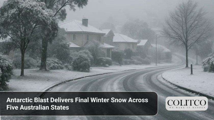
The weather system represents one of the most widespread snow events in years across southeast Australia. Sunday marks the last day of winter with frosty morning conditions giving way to drier, calmer weather and temperatures climbing back to average levels.