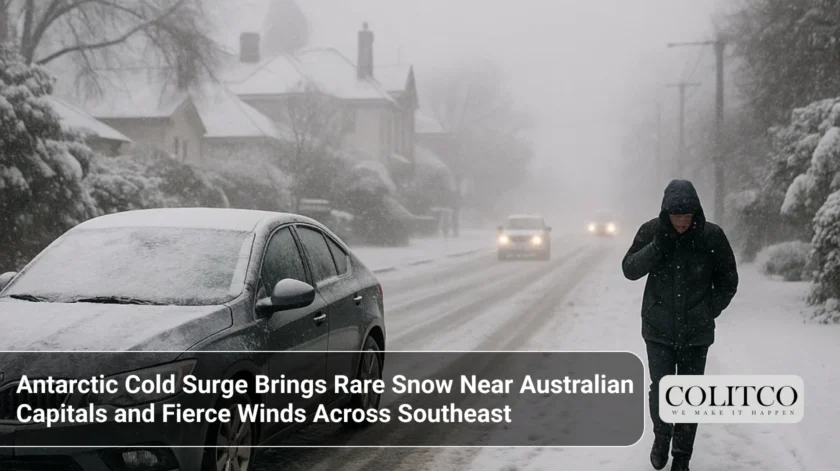
A rare Antarctic blast is sweeping across southeast Australia, bringing one of the biggest snow events in years within 35 km of five capital cities, along with damaging winds and blizzard conditions. Snow showers will fall near Canberra, Hobart, Melbourne, Sydney, and possibly Adelaide.
Severe Weather Update video Fri 29 August 2025: Windy, cold weather for south-east Aus.
Video current: 12.30pm AEST Friday 29 August 2025.
For the latest forecasts and warnings go to our website https://t.co/4W35o8iFmh or the BOM Weather app. pic.twitter.com/qNI2SQmsBy
— Bureau of Meteorology, Australia (@BOM_au) August 29, 2025
Snowfall Details by Location
The coldest air will impact South Australia on Friday evening, dropping snow above 800 metres in the Southern Flinders Ranges and above 700 metres in the Mount Lofty Ranges. Snow levels then fall further across eastern states overnight, down to around 600 metres in Victoria, 700 metres in New South Wales, and as low as 300 metres in Tasmania.
Adelaide is a little exposed to a few degrees of snow at the higher Mount Lofty Ranges, only 11 kilometres north-south of the city centre. About 35 kilometres north-west of its north-west suburbs, Melbourne foresees snow around Mount Macedon overnight and early on Saturday. The Kunanyi/Mount Wellington summit will be blanketed in snow on the upper part of Hobart early on Saturday. On Saturday morning, Canberra is going to have snow on many of the city hills. The nearest snowfalls will be seen in the Blue Mountains, approximately 30 kilometres from the outer western suburbs of Sydney.
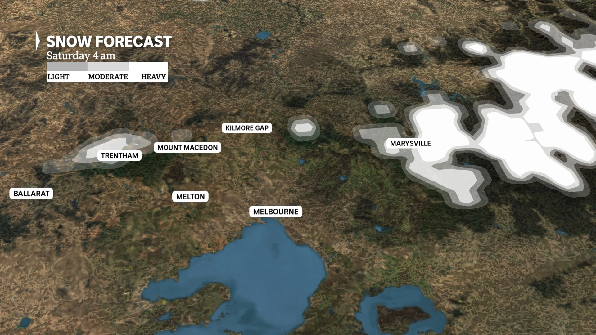
Forecasted snowfall near Melbourne
Snow Blanket on the Great Dividing Range and Regional Towns
Apart from capital city outskirts, many regional towns will see snow cover Saturday morning. In NSW, snowfall will likely affect Orange, Lithgow, Oberon, Monaro towns, Bowral, Goulburn, and northern towns like Guyra and Walcha. Victoria’s snow areas include Trentham, Omeo, the Grampians, and the highest peaks of the Otway and Strzelecki ranges.
Alpine regions have already seen snowfall for almost 48 hours, with an additional 40 centimetres forecast for Friday night, potentially accumulating near one metre on higher slopes. Tasmania expects snow close to sea level overnight, but no recurrence of the 2015 event with snow reaching Hobart’s beaches is forecast. Snow cover will largely clear by mid-morning Saturday, but cold temperatures will preserve snow at higher elevations through to Monday.
![]()
Mount Hotham under a blanket of fresh snow on Thursday
Other Winter Weather Effects
Isolated hail is likely in southern NSW, agricultural South Australia, and Victoria during the polar outbreak. Gale-force winds will accompany the cold blast, risking property damage and power outages.
Strong Winds and Power Outage Risks
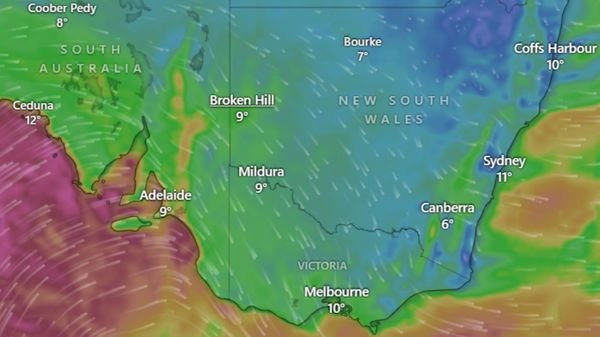
Wind gusts of 90 to 100 kilometres per hour are forecast across South Australia, Victoria, and NSW over the next 24 hours. These winds are strong enough to bring down tree branches and topple trees. The low-pressure system driving the storm will cause even stronger gusts of 110 to 115 kilometres per hour near the system centre as it moves through Bass Strait, affecting the south-east coast of SA, western and central Victoria’s coast, and Gippsland into Saturday.
Winds reaching 130 kilometres per hour may affect some parts of SA, regional Victoria and the Riverina, and this is the strength of a category two tropical cyclone. These are high speed winds, which may cause roof damage, tree fall and airborne debris like trampolines. There will be snow white-outs and damaging winds in the regions in the Alps over 1,200 metres, causing blizzard weather.
Wind chill will create apparent temperatures about 10 degrees Celsius lower than the actual air temperature. For example, Adelaide’s forecasted 13 degrees maximum will feel closer to 5 degrees. Sydney’s 17 degrees expected on Saturday will feel under 10 degrees with wind chill.
South Australia’s Early Storm Impact
Staff of the South Australia State Emergency Service (SES) received hundreds of emergency calls in the morning hours on Friday after a devastating storm struck the area. Huge gum trees were broken down and blocked the road, and destroyed houses. Strong gusts were reported and residents reported roof collapses and debris damage. Wind gusts are predicted to go as high as 130 kilometres per hour.
The polar blast has moved on with severe weather warnings being issued by the Bureau of Meteorology in South Australia, Victoria, and NSW. In the morning, 60 to 100 kilometres per hour winds were recorded along the SA coast. The conditions are expected to improve slowly in the west throughout Friday evening, but it may continue into late evening in the lower south east of the state.
The communities that may be adversely impacted are Adelaide, Port Lincoln, Whyalla, Renmark, Mount Gambier and Ceduna. A gale warning is a broad area of coastal coverage such as the Adelaide metropolitan waters. The SES advises against the use of the boats for the next two days because of strong winds.
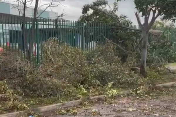
Trees snapped after a heavy storm in Adelaide
Warnings for Victoria, NSW, ACT, and Tasmania
The damaging and strong winds are being predicted for residents of Victoria, New South Wales, the Australian Capital Territory, and Tasmania on Friday and the weekend. North-westerly airflow will intensify and bring gusts of up to 100 kilometres per hour in high places. Most areas above 1,200 metres in the NSW Snowy Mountains and the Eastern Ranges of Victoria will be under heavy snowfall and blizzard conditions.
Predicted maximum temperatures on Friday are 13 degrees for Adelaide, 14 degrees for Melbourne, and 21 degrees for Sydney, but wind chill will lower the perceived cold significantly.
Winter’s Final Blast on ACT
A strong cold front brings damaging winds and possible snow down to 700 metres in the ACT. The Bureau of Meteorology warns of winds up to 100 km/h and blizzard conditions above 1,200 metres. Canberra will have cloudy weather with 5 to 15 mm of rain, reaching 14°C on Friday. Saturday starts frosty at 13°C with light showers, warming to 20°C by Tuesday. ACT Policing urges caution on roads and advises postponing outdoor activities in snowy or windy conditions.
Winter’s Final Blast in NSW
The cold front is causing destructive winds as high as 100 km/h, and snow at altitudes as low as 700 metres in southeast NSW. There were even 42 mm of rainfall in such locations as Perisher with good gusts along the coastline. In the alpine regions, blizzard conditions are probably more than 1,200 metres. Officials are encouraging people not to travel to the backcountry since the conditions are dangerous. A red tide is issued as a dangerous surf warning in NSW on Saturday. Drivers should drive with care and listen to government warnings.
State Emergency Service Safety Advice
The SES urges residents to move vehicles under cover or away from trees. Loose items around homes, yards, and balconies should be secured or stored. People must avoid fallen power lines or energised objects such as fences, staying at least eight metres clear. The SES reminds that fire-damaged trees may fall more easily.
Power line falls are to be reported to the regional power suppliers indicated on power bills. Society must remain vigilant to the progressive conditions, particularly in post bushfire periods. SES is available on the hotline at 132 500 in case of emergency help during floods and storms.
This polar outburst causes extensive snow, heavy winds and low temperatures in the southeastern parts of Australia, which has threatened property and safety in the areas during the weekend. Individuals and tourists ought to be ready and listen to the governmental warnings.