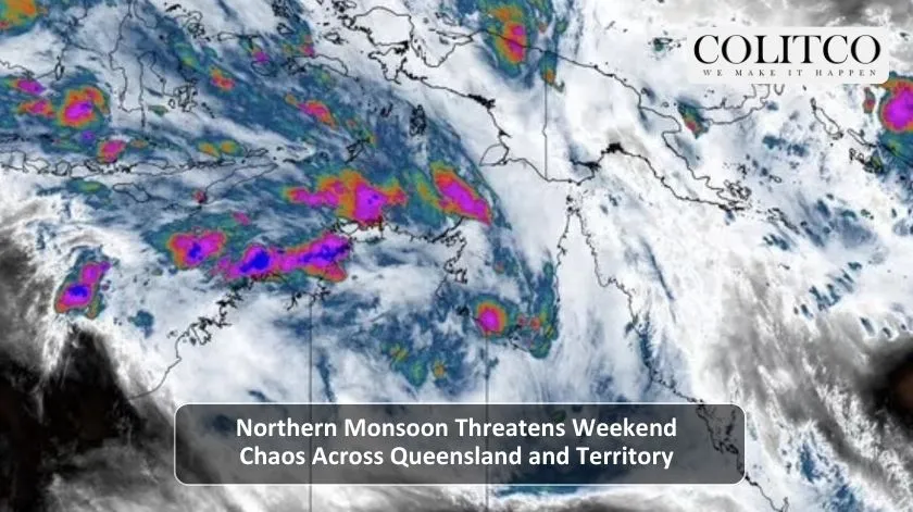
Australia’s north faces a dangerous weekend as meteorologists warn of widespread flooding across Queensland and the Northern Territory. Heavy rainfall totals could exceed 300 millimetres in some areas between now and early next week.
The Bureau of Meteorology issued extensive flood watches on Friday morning, covering regions from eastern Northern Territory through to Queensland’s coastal areas. Communities already devastated by floods earlier this year are preparing once again.
Monsoonal System Driving Weekend Deluge
A slow-moving low-pressure system is drawing tropical moisture across northern Australia. This weather pattern is expected to produce persistent heavy rainfall from Saturday through to at least Tuesday.
The Bureau’s forecast shows the heaviest falls concentrated in three key areas:
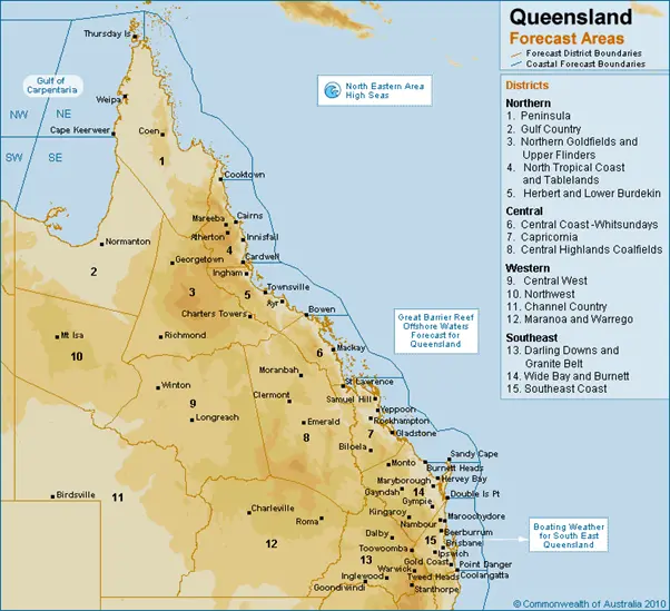
- North-western Queensland and Gulf Country
- Northern Interior extending to the North Tropical Coast
- Coastal zones between Cairns and Bowen
Purple and black colours on rainfall prediction maps indicate where totals may exceed 300mm over the coming days. Some isolated areas could see significantly higher accumulations.
Townsville weather remains a particular concern after the city experienced devastating floods earlier this year. In March, Townsville recorded more than 700mm in just 72 hours.
Multiple River Systems Under Watch
Major flood warnings are likely as rivers respond to the sustained rainfall. The Bureau has identified several catchments at high risk:
Flooding is expected to develop across rivers in north-western Queensland, the Gulf of Carpentaria region, and northern coastal catchments. The Queensland flooding risk extends from established river systems to smaller creeks and drainage lines.
Flash flooding presents an immediate danger. Intense rainfall rates could overwhelm urban stormwater systems and cut off remote communities.
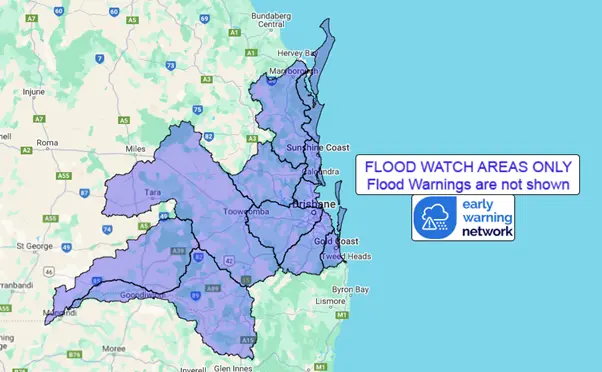
Extensive flood watch areas covering northern Queensland and eastern Northern Territory
Northern Territory Communities Also Threatened
The Northern Territory faces similar conditions as the same weather system extends westward. Flood watches cover large portions of the territory.
Remote communities are particularly vulnerable. Many smaller settlements become completely isolated when rivers overflow and roads wash out during the wet season.
The Bureau warns that flooding across the Northern Territory could persist for days or even weeks once river levels rise. Communities in flood-prone areas should prepare for extended isolation.
Timing and Uncertainty
Saturday and Sunday will see the heaviest rainfall across affected regions. However, meteorologists caution that exact locations remain difficult to predict.
“It’s really going to depend on where this low-pressure system moves,” the Bureau stated in Friday’s update. The system could drift further south across western Queensland or track differently than current models suggest.
Residents should monitor conditions closely throughout the weekend. The situation may change rapidly as the system develops.
Earlier Floods Cost Queensland Over $1 Billion
This latest threat comes as communities continue recovering from earlier 2025 flooding events. Flooding Queensland regions experienced in February and March caused an estimated $1.2 billion in economic damage.
Record-breaking rainfall earlier this year forced thousands of evacuations. One person died in Ingham when a rescue boat capsized. The Bruce Highway suffered major damage, cutting off supply routes to northern communities.
Townsville, Ingham, and Cardwell bore the brunt of February’s floods. Some areas recorded over one metre of rain in just one week.
The agriculture sector faced severe losses. Cattle stations across the north remain vulnerable to further inundation.
What Residents Should Do Now
Emergency services urge people in flood-prone areas to prepare immediately:
- Secure outdoor items and move valuables to higher ground
- Stock up on essential supplies including food, water, and medications
- Charge mobile phones and prepare battery-powered radios
- Know your evacuation routes and have a plan ready
- Never drive through floodwaters
The Queensland Fire and Emergency Services activated emergency response protocols ahead of the weekend. Swift water rescue teams are positioned throughout at-risk regions.
Climate Change Connection
Scientists note that slow-moving tropical lows have become more frequent in recent years. These systems tend to stall over land, dumping enormous rainfall totals over several days.
The pattern mirrors previous major flooding events across Queensland. Warmer ocean temperatures provide more energy and moisture for these systems.
Intense rainfall events are becoming heavier and more frequent as global temperatures rise. Australia faces growing challenges managing extreme weather impacts.
Forecast May Change
The Bureau emphasises that weekend forecasts could shift as new data becomes available. Multiple weather models show slightly different tracks for the low-pressure system.
Residents across northern Queensland and the Northern Territory should check the Bureau of Meteorology website regularly for the latest warnings and updates.
Emergency services will provide updated advice throughout the weekend as conditions develop. Local councils are preparing evacuation centres in case they’re needed.
The coming days will test emergency response systems across Australia’s north. Communities that faced repeated flooding through 2025 now brace for another potential disaster.
Also Read: Ukraine’s Zelenskyy Confirms Upcoming Meeting With Trump as Peace Negotiations Continue
FAQs:
Q: Which areas of Queensland face the highest flood risk this weekend?
A: North-western Queensland, the Gulf Country, Northern Interior, and coastal areas between Cairns and Bowen face the most significant flooding threat.
Q: How much rain is expected?
A: Widespread areas could see several hundred millimetres. Some locations may exceed 300mm over the next 5-7 days, with isolated higher totals possible.
Q: When will conditions be worst?
A: The heaviest rainfall is forecast from Saturday into Sunday, though persistent rain could continue into early next week depending on the low-pressure system’s movement.
Q: What should people in flood-prone areas do?
A: Monitor Bureau of Meteorology warnings closely, prepare emergency kits, secure property, and be ready to evacuate if authorities issue warnings.