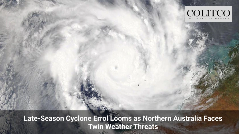
Northern WA Braces for Wet and Windy Weekend
A tropical low off the northern coast of Western Australia could develop into a cyclone this weekend. The Bureau of Meteorology reported on Friday that Tropical Low 29U was north of Darwin. It was tracking south-west towards the remote Kimberley coast. Forecasts suggest the system may intensify into Tropical Cyclone Errol by Saturday.
Watch Zone Issued Across Kimberley Coastline
Authorities placed a watch zone from Cockatoo Island to Berkeley River Mouth. The Bureau expects gales and damaging gusts. Heavy rainfall could impact the region by Saturday night. The system could bring destructive winds and increased rainfall to Broome by Monday. Broome lies roughly 2,000 kilometres north of Perth. Island and coastal communities have been urged to monitor forecasts closely.
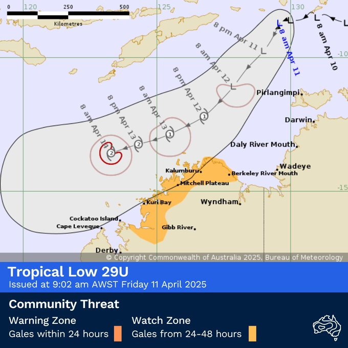
Figure 1: Tropical Low 29U forecasted to become a tropical cyclone on Saturday
System Could Reach Category Two Intensity
The bureau expects the system to intensify over the weekend. By Sunday night, it may reach category two strength. Bureau forecaster Angeline Prasad confirmed the high likelihood of cyclone formation. “We do expect the system to intensify into a tropical cyclone on Saturday,” Ms Prasad said. “The chances of this system intensifying into a tropical cyclone has been upgraded to a high chance now.”
Tracking Parallel to Kimberley Coast
The weather system is forecast to move parallel to the Kimberley coastline. Prasad noted it may recurve later next week. However, the track beyond Sunday remains uncertain. “It may recurve into the coast in the middle of next week but there are large uncertainties associated with the tracking of the system beyond Sunday,” she said.
Rainfall Forecasts for Northern WA Communities
The Bureau advised increasing showers and thunderstorms over the next few days. Areas such as Kalumburu, Wyndham, and Kununurra may see rainfall between 20 to 50 millimetres. “The heaviest falls are most likely going to stay offshore,” Ms Prasad said. “However, it is possible we could start to see rainfall in the order of 20 to 50 millimetres associated with the increasing showers and thunderstorms.”
Cyclone Preparedness Urged by Bureau
Prasad encouraged residents to prepare kits. “If you haven’t already prepared your kit, this is the time to prepare it,” she said. She reminded communities to store food and water. Residents should also identify nearby evacuation centres.
Recent Cyclone Dianne Brings Memories of Flooding
Dianne struck West Kimberley last month. It made landfall as a category one system. The cyclone delivered significant rainfall to Derby. Communities affected by Dianne remain alert for further weather events.
Second Tropical Low Brewing in Arafura Sea
Another system could form in the eastern Arafura Sea or Gulf of Carpentaria. This tropical low could develop into a cyclone by late next week. The Bureau gave this system a low chance of intensification next week. However, it could still bring wet weather to the Northern Territory and Far North Queensland.
Most Active Cyclone Season in Six Years
Australia may record its most active cyclone season in six years. Weatherzone confirmed this potential earlier this week. Seven tropical cyclones have already formed since November 2024. These include Sean, Zelia, and Alfred.
Prior to this week, ten cyclones had developed in Australian waters. The season runs from November to April. One more system could break the six-year record. The next cyclone to form will be named Errol.
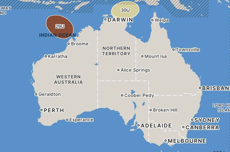
Figure 2: The two tropical cyclones brewing in Northern Australia
Meteorological Drivers Behind Cyclone Formation
An equatorial Rossby wave is influencing tropical cyclone activity. This wave increases the likelihood of storm development near Australia’s northern coastline. Current cloud patterns support the forecasts. The tropical wave is increasing atmospheric instability. Warm ocean waters north of the Kimberley may further intensify the systems.
Computer Models Show Multiple Possibilities
Forecast models vary on the paths of the two systems. Some models suggest the Arafura low may track into the Timor Sea. Others show the second low forming by Wednesday next week. While the second system has a low development chance, meteorologists remain watchful.
Communities across the Top End and Cape York Peninsula could see rainfall between 100 to 200 millimetres. These regions may also experience thunderstorms. The Bureau will release updated guidance as models improve.
Residents Advised to Remain Alert
The Bureau continues to monitor the systems. Updates will be provided over the weekend. Authorities recommend all residents in affected areas prepare for changing weather conditions.