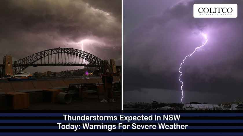
Stormy weather is going to hit the New South Wales territory today, and all the people living there have been warned to take precautions. Thunderstorms that are predicted could cause rain, wind, and hail, besides just the thunder and lightning. The NSW weather alert from the Bureau of Meteorology took effect today for the whole area of New South Wales. This alert is mainly for the four biggest cities, i.e., Sydney, Newcastle, Wollongong, and the huge area in the middle of the state.
Stormy weather to hit New South Wales today; residents warned.
What’s Happening Across The State?
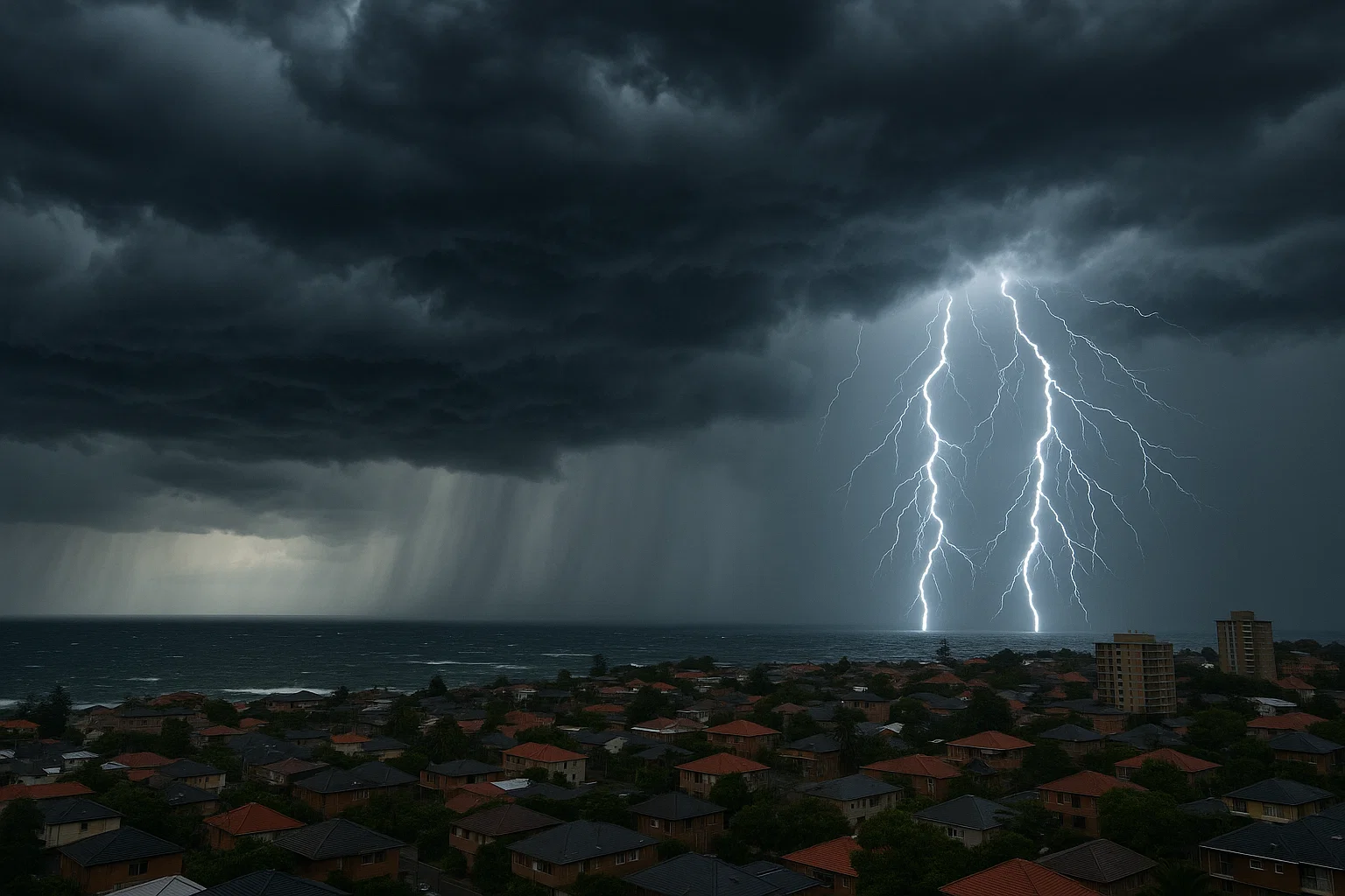
The meteorological department observed issues with thunderstorms around Leppington and Bringell, which are southwest of Sydney. The area where the storms took place was very active with lightning, strong winds, and possibly even hail on Friday afternoon. The BOM has issued warnings to people in different parts of the metropolitan area. By the time it was 8:30 pm, the warnings for the metro region that included Newcastle and Wollongong were rescinded because the storms had weakened. Nevertheless, some places are still being monitored.
Experts in weather forecasting indicated that the atmosphere’s instability was the very reason for the storms to develop. The combination of hot and humid air, along with a cold front moving by, made it very dangerous. A sudden but very heavy rainfall was experienced in the western suburbs of Sydney, and there were power outages in some areas.
Where Will The Storms Move Next?
Bureau of Meteorology (BOM) forecasts indicate storms will be moving north and inland during the night. The Mid North Coast, North West Slopes and Plains, and Upper Western districts are the areas that will be most affected. The local government has already given warnings about the possibility of isolated supercell thunderstorms that would produce very high wind gusts of up to 125 km/h and larger hailstones of up to 5 cm in diameter. Heavy storms are always associated with disruptions caused by fallen trees, damage to properties, and the like.
Emergency services are asking the public to do last-minute preparations such as putting away outdoor furniture, cleaning gutters, and keeping batteries of devices fully charged in case there is a power cut. The NSW weather alert for today is still on, and updates are being shared with the residents. Besides, motorists are advised to be extra careful on the roads, which might be slippery due to heavy rains and poor visibility.

BOM predicts storms moving north and inland, hitting key NSW districts.
Why Are Thunderstorms Forming So Intensely?
There is a low-pressure trough combined with a cold front that is currently passing across New South Wales, meeting hot air from the interior. This temperature difference is what mainly causes the thunderstorms. The upper-level trough, however, pushes up the instability so that it is possible for the towering clouds to be formed in no time. Meteorologists pointed out that the condition of the atmosphere is abnormally active for October, which indicates the arrival of summer early.
On Friday, the temperature at Sydney Airport was 34.7 °C, whereas parts of western New South Wales experienced temperatures above 35 °C. This hot air is a source of energy that intensifies the storms. Thus, according to weather experts, the changing climate pattern might lead to an increase in the number of thunderstorm events this season as one of its consequences.
What Are The Safety Precautions?
Residents should take shelter indoors during thunderstorms and refrain from using wired electronics. It would be wise to relocate cars away from trees and power lines so that the risk of damage is minimised. The owners of pets should keep their pets indoors, as thunder might cause distress.
The State Emergency Service (SES) has received multiple calls concerning fallen trees and blocked drains. They keep informing the public that driving through floodwaters is very dangerous, even if the water is shallow. Power companies have set up additional teams to deal with possible outages caused by lightning strikes or falling trees.
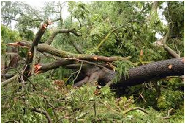
SES reports fallen trees, warns against driving through floodwaters; power crews are ready.
Will Conditions Improve Tomorrow?
Weather forecasters predict that the storm will move to the east quite soon, thus improving the weather situation on the coast. Nevertheless, there might be rain and isolated thunderstorm activity on Saturday, especially in the north. After the front passes, the temperature will go down a little due to the inflow of cooler air.
The NSW heavy rain forecast a maximum of 40 mm or 20 mm of rain in the areas likely to be affected. The area of Sydney experiencing bad weather could calm by morning, while rural places could still have thundery conditions till the weekend. Residents are advised to keep checking for the latest safety information through BOM alerts and local council updates.
How Should Residents Prepare For Ongoing Weather Changes?
Experts think that it’s better to revise household emergency plans and keep basic supplies like flashlights and batteries ready. Inhabitants of inland regions are advised to keep a close watch on their fields and animals, as a sudden storm can cause loss due to hail or flooding. People residing near the coast should take precautionary measures for their boats and gear before the new rainfall.
A senior forecaster from BOM has pointed out that the possibility of the immediate threat disappearing tomorrow is there; however, unstable conditions are still in the atmosphere. The weather pattern might bring forth more storms again early next week, given that the moisture content remains high. The bureau advises all to be cautious and take every severe weather advisory seriously to avoid injury and protect property.
Also read: Police Powers Overturned in NSW In Landmark Court Decision
Frequently Asked Questions (FAQs)
Q1: Which parts of NSW are predominantly impacted by the storms today?
Severe thunderstorms are affecting certain regions of Sydney, the Hunter, the Mid North Coast, and the western parts of the inland area.
Q2: Do the storms have a chance of continuing throughout the night?
Certainly, Lightning and rain in some places may last through the night and only slightly reduce by the morning.
Q3: Are there chances of floods resulting from the storms?
Again, Yes. The weather prediction for heavy rains in NSW leads to flash flooding being a possibility, especially in the lower areas.
Q4: What actions should people living in a thunderstorm area take?
People should stay inside, keep away from metal objects and tall trees, and keep listening to the updates provided by BOM and emergency services.