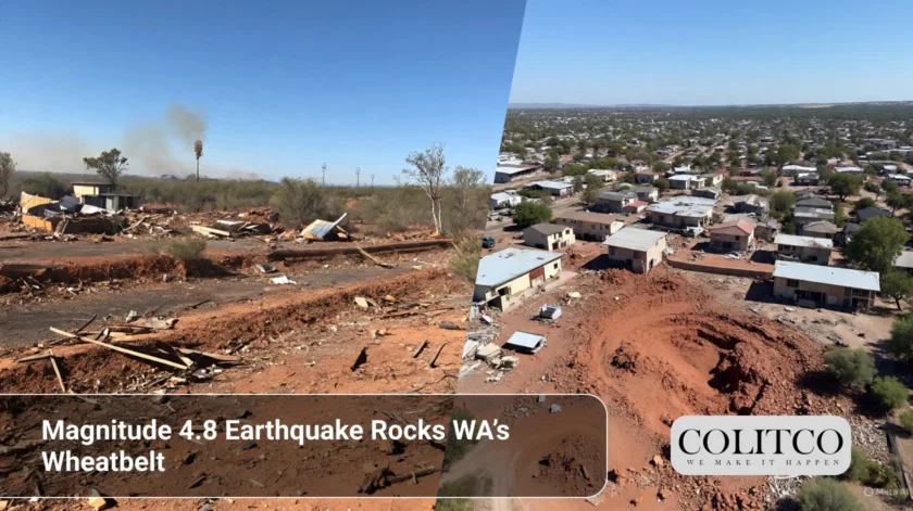
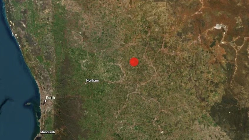
Unleashing a strong tremor in Western Australia, locals from the Wheatbelt region found their beauty sleep broken in the wee hours of Wednesday. At 4.8 on the Richter scale, the quake occurred some 200 kilometres north-east of Perth, near Wyalkatchem. It ranks as one of the strongest registered in the area for the year.
The tremor struck at 2:06 am AWST on 30 September 2025, with Geoscience Australia confirming that the epicentre was about 30 kilometres south-east of Wyalkatchem, at a depth estimated to be just one kilometre.
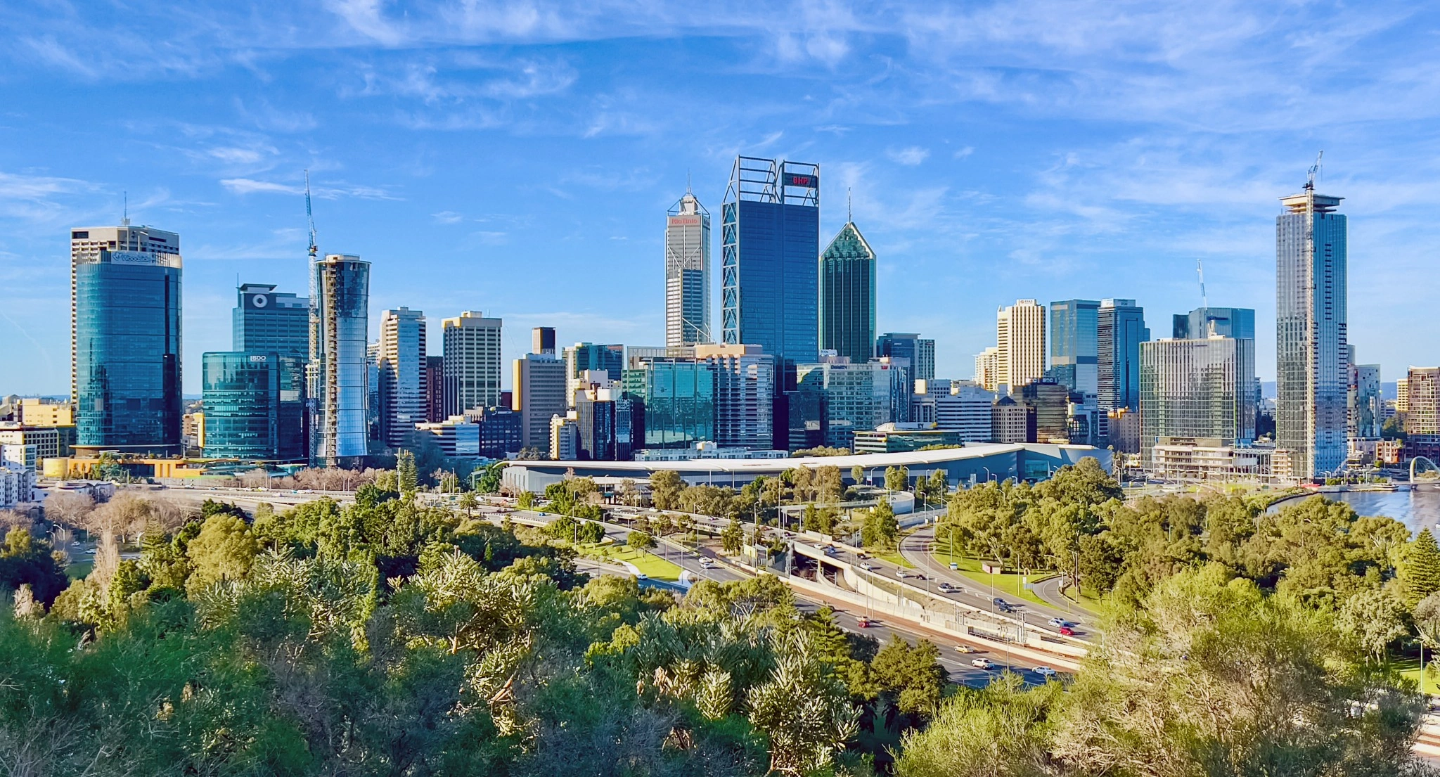
More than 500 people reported feeling the quake; shaking was confirmed as far as Perth, Kalgoorlie, and other towns around south-western WA.
No reports of damage or injuries existed. Throughout the morning, emergency services were on alert for any potential risks.
4.8 magnitude earthquake in WA
How Did the Earthquake Affect Residents?
Those in the Wheatbelt region were jolted and startled by the shaking. At first, some suspected it was a big truck passing in front of them. Others reported their walls rattling and windows trembling.
“I was deep in sleep when suddenly everything started shaking,” said a local from Wyalkatchem, Megan Turner. “It felt like that loud rumble from beneath the house.”
In Perth, the tremors were also felt in the suburbs of Midland, Ellenbrook, and even as far away as Rockingham. Residents talked of a brief but perceptible vibration, strong enough to wake anyone who was a light sleeper.
The unusual strength was witnessed again with reports from Kalgoorlie, some 400 kilometres away from the epicentre.
Aside from the fright, authorities confirmed that there was no structural damage or cessation of essential services.

Why Is Wyalkatchem Experiencing Earthquakes?
The area surrounding Wyalkatchem lies within the South West Seismic Zone in WA, which is one of the most talked-about active fault zones in the Australian continent.
According to Geoscience Australia, over 130 small earthquakes have been recorded near Wyalkatchem in the past 12 months. These earthquakes mainly vary between the ranges of magnitude 1.5 and 3.5.
But in comparison with those slight tremors, the 4.8 magnitude shake on a Wednesday was a large one. The last time a quake of magnitude 4.5 had been registered was some years ago.
Structural geologist Dr. Louise Elders gave an explanation for the cause. “This is an area of deep crustal stress,” she said, “and this means Earth has been slowly releasing tension through these seismic events.”
She also added that small tremors could go on for days to weeks. The aftershocks, if they are shallow enough, might still be felt by the residents.
Should Perth Be Worried About Future Quakes?
Seismologists consider a bigger, destructive earthquake as unlikely, but not impossible.
Dr Allen from Geoscience Australia explained: “Earthquakes in this zone are often moderate. They release stress without major consequences.”
He said, “Magnitude 5.5 to 6.0 earthquakes remain rare in Australia, particularly in populated areas.”
Still, vigilance is advised. Locals need to secure heavy furniture and learn some basic safety awareness.
“In preparation lies safety,” says Dr Allen. “Even moderate earthquakes can damage buildings if they are vulnerable.”
What Is the Government Doing in Response?
Emergency agencies all across the Wheatbelt conducted checks through Wednesday morning. Buildings in Wyalkatchem, Dowerin, and surrounding areas were inspected as a precaution.
The Department of Fire and Emergency Services (DFES) of WA confirmed that there are no reports of major incidents; however, should anyone notice a crack on any building or bridge, or any structural concerns, they are urged to inform DFES promptly.
Geoscience Australia urges residents to submit felt reports on their website, as such citizen responses assist the scientists in determining the distance from which the quake was felt.
The spokesman stated, “Public input is critical. It helps our research and makes it possible to improve response plans.”
The authorities also said that WA building codes are designed with seismic activity in consideration, particularly in known hotspots.
https://youtu.be/U6KxiwdFAn0?si=CzYynuK7pQ4Gk2A1
Does This Compare to Meckering’s Historic Earthquake?
Many locals compared Wednesday’s quake to the infamous 1968 Meckering earthquake. That event, 130 kilometres south-west of Wyalkatchem, topped at magnitude 6.5.
The Meckering earthquake destroyed 60 homes and caused havoc in the surrounding area, ranking among the biggest seismic disasters that hit Australia.
Although it was of smaller magnitude, this earthquake had an effect on the older persons who sat with such memories.
“I lived through Meckering,” said 79-year-old Keith Doyle. “This one was short, but it brought back those old fears.”
Scientists feel a repeat of Meckering-related intensities is unlikely. However, interest continues to be drawn from the activity in this seismic zone.
Also Read: Strong Earthquake Jolts Greek Islands, Tourists Feel Tremor in Popular Holiday Spot
What Can Residents Do Now?
Authorities are counselling people to remain calm but alert.
Anyone who felt shaking should lodge their reports at Geoscience Australia’s “Did You Feel It?” portal. Those with visible damage are requested to contact the DFES or their local council authorities.
General precautions include checking for gas leaks, ensuring all heavy items are secured, and keeping emergency kits handy.
“Because it isn’t unusual for this area. So awareness and preparedness are essential,” said Dr. Elders.
Especially people residing in older buildings or buildings without reinforcements are encouraged to review building safety.