Castle AI Wayfaring System Tackles GPS Blackspots
Sydney-based technology firm Advanced Navigation has trialled a groundbreaking indoor navigation system for GPS-denied environments. The system, developed as castle part of the NSW Government’s Hyperlocal Navigation Challenge, aims to assist vision-impaired commuters in public transport hubs.
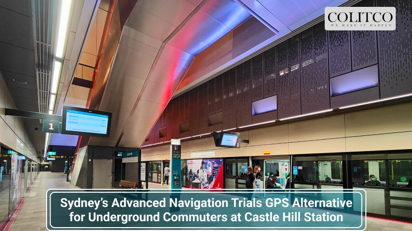
The challenge, managed by the Office of the NSW Chief Scientist & Engineer, saw Advanced Navigation partner with Transport for NSW, Sydney Metro, and the University of Technology Sydney (UTS). Their pilot system was tested at Castle Hill Station.
Advanced Navigation’s Indoor Positioning Systems Installed across Castle Hill Station
Trial Aims to Enhance Public Transport Accessibility
Advanced Navigation’s co-founder and CEO Chris Shaw highlighted the limitations of traditional GPS. “GPS helps people find their way, but it comes with limitations. In underground train stations, for example, its performance significantly drops,” said Shaw.
He added that the technology was adapted to help commuters who rely on voice navigation. “This pilot program is a powerful example of taking our core navigation technology and creatively applying it to a high-impact, real-world problem. It was rewarding to see its potential to break down barriers and improve accessibility where it’s needed most.”
The trial included direct consultations with vision-impaired users to assess real-world navigation challenges. Simulations were also conducted at UTS campuses to refine the system under GPS-denied conditions.
System Offers Precise Smartphone Tracking
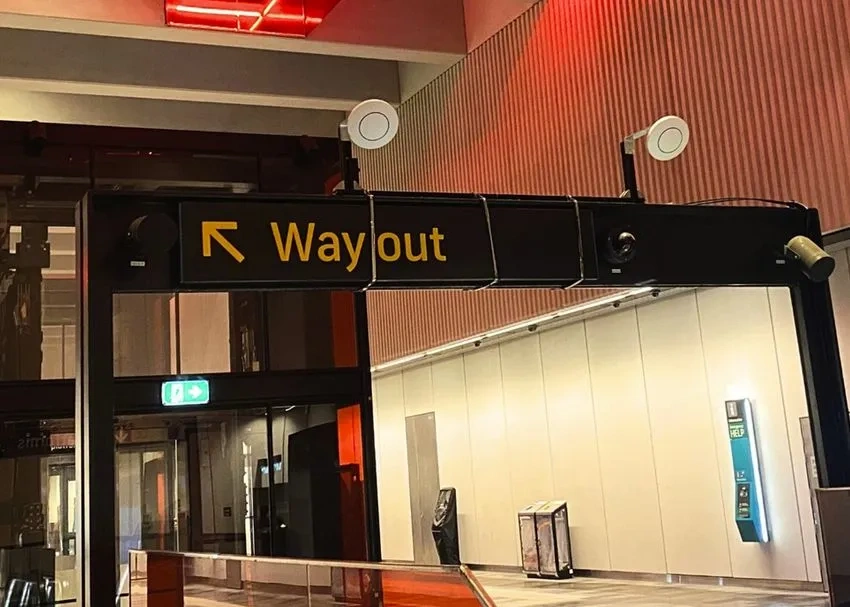
The demonstration installed eleven positioning units across Castle Hill Station. These used phased array ultra-wideband (UWB) and Bluetooth Low Energy (BLE) to track users within 10 to 30 centimetres. The system did not rely on GPS and functioned entirely indoors.
Users could access real-time positioning through their smartphones, enabling seamless movement across platforms, escalators, and lifts. The trial proved that accurate location updates are possible underground, improving safety and navigation for commuters.
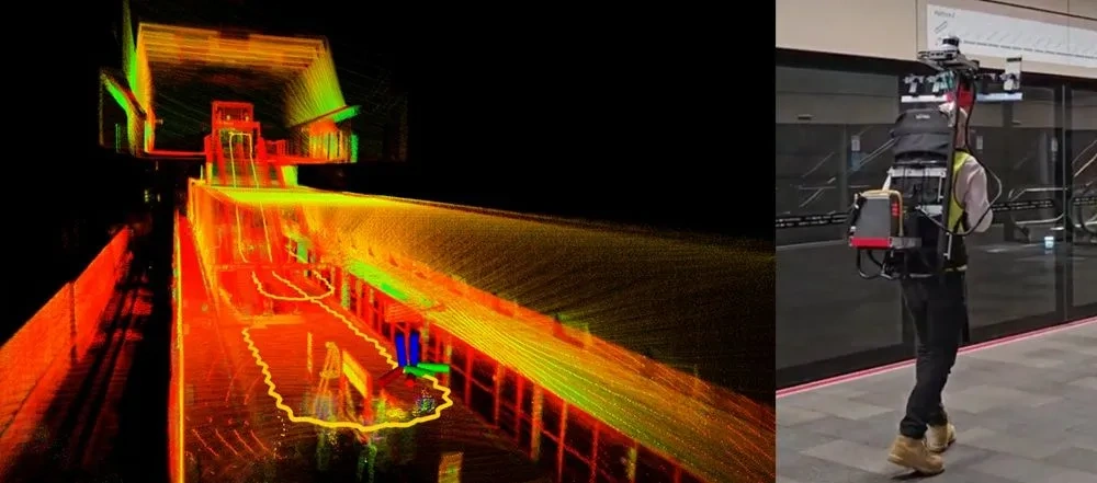
To validate performance, researchers conducted a dual test using smartphones and LiDAR scanners. Smartphones collected positioning data while LiDAR units generated 3D station maps. This comparison confirmed the system’s precision and response time.
NSW Chief Scientist Supports Research Push
NSW Chief Scientist & Engineer Hugh Durrant-Whyte praised the innovation. “Continuous research and development is key to driving innovative solutions to our most challenging problems,” said Durrant-Whyte.
He also noted the importance of equity. “Advanced Navigation’s pilot indoor positioning technology offers real promise to improve equity and access to public spaces for the visually impaired community.”
BindiMaps Also Active in Indoor Navigation Space
Another Sydney startup, BindiMaps, has worked on indoor wayfinding solutions. Its app supports navigation in public spaces and commercial buildings. Clients include Vicinity Centres (ASX: VCX), Mirvac (ASX: MGR), and Brookfield Properties.
BindiMaps technology has also been used internationally, including at Budapest Airport. Business News Australia has requested a current update from the company. Co-founder Mladen Jovanovic stepped aside in mid-2024.
Also Read: Justin Bieber Surprises Fans With ‘Swag’ – A Bold Reflection of Growth and Confidence
Advanced Navigation Expands Technology Portfolio
Advanced Navigation continues to broaden its research and application focus. In June 2025, the company reported a separate breakthrough in ocean monitoring. Its Hydrus subsea drone captured data on coral bleaching along the southern WA coastline.
A partner on the reef project described the data as “essential for informing conservation strategies and building the baseline needed for long-term reef recovery.”
The company’s other co-founder, Xavier Orr, is also exploring new frontiers. Orr is developing an artificial intelligence brain for humanoid robots through his new venture, Anitron.
Real-World Results Highlight Future Potential
The Castle Hill trial achieved smartphone localisation within a 10–30 centimetre range. That result confirmed the system’s ability to guide commuters accurately in real time without GPS.
Advanced Navigation’s integration of UWB and BLE technology offers a scalable model. It allows public transport operators to improve commuter experiences without overhauling existing infrastructure.
The pilot highlights how AI and smart sensors can bridge technology gaps in real-world situations. It also reinforces how strategic partnerships between government, academia, and private firms can deliver community benefits.
Company Aims to Scale Indoor Positioning System
Advanced Navigation plans to explore commercial applications for the indoor positioning technology. The company continues to support public accessibility and infrastructure innovation through new projects.
Its existing footprint in subsea, aerospace, and robotics strengthens the potential for broader adoption. As part of the NSW Hyperlocal Navigation Challenge, the Castle Hill success positions Advanced Navigation for further smart infrastructure deployments.