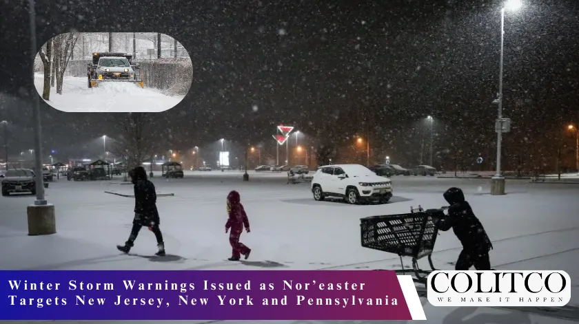
A powerful winter storm will impact the Northeast this weekend, prompting winter storm warnings and blizzard alerts across parts of New Jersey, New York, and Pennsylvania. Forecasters expect heavy snowfall totals ranging from 8 to 20 inches in several areas, along with strong winds and hazardous travel conditions. The system will move through the region from late Saturday into Sunday, affecting millions of residents.
Heavy snow falls across the Northeast as winter storm warnings remain in effect for several states. [Istock]
Meteorologists report that the storm will intensify rapidly as it tracks along the East Coast. Officials urge residents to prepare for significant snow accumulation, reduced visibility, and possible power outages. Authorities have already begun monitoring road conditions and emergency response readiness.
Winter Storm Warnings and Blizzard Alerts Across the Region
The National Weather Service has issued winter storm warnings for large portions of New Jersey and southeastern Pennsylvania. Blizzard warnings cover parts of coastal New Jersey and sections of the New York metropolitan area. These alerts reflect the risk of heavy snow combined with wind gusts strong enough to reduce visibility to near zero at times.
Weather alerts show winter storm warnings and blizzard conditions across parts of the Northeast. [Fox News]
In New Jersey, forecasters predict widespread snow totals between 8 and 20 inches. Some coastal and central counties could see amounts near the higher end of that range. Officials emphasize that the combination of snow and wind will create dangerous travel conditions throughout the weekend.
Snow Timing and Forecast Updates for New Jersey
Snow will begin in southern New Jersey late Saturday afternoon before spreading northward during the evening. By late Saturday night, most of the state will experience steady snowfall. The heaviest bands are expected overnight into early Sunday morning.
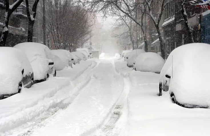
Meteorologists expect snowfall rates to exceed one inch per hour during peak intensity. This rate could lead to rapid accumulation on untreated roads. State transportation crews plan to deploy plows and salt trucks ahead of the storm’s arrival.
Snow-covered highways create hazardous travel conditions during peak snowfall. [Drivewise]
Philadelphia and Southeastern Pennsylvania Snow Impact
The winter storm will also affect Philadelphia and the surrounding counties. Snow will develop Saturday evening and intensify overnight. Forecasters expect totals between 6 and 12 inches across the Philadelphia metro area, with locally higher amounts in some suburbs.
City officials have urged residents to limit travel during peak snowfall. Emergency management teams continue to coordinate with utility providers in case heavy snow and wind disrupt power lines. Authorities stress that drivers should avoid unnecessary travel during the height of the storm.
New York City Forecast: Snow Sunday and Strong Winds
New York City will experience snowfall beginning late Saturday night, with heavier accumulation on Sunday. Forecasters expect several inches of snow across the five boroughs, while parts of Long Island and coastal areas could see higher totals.
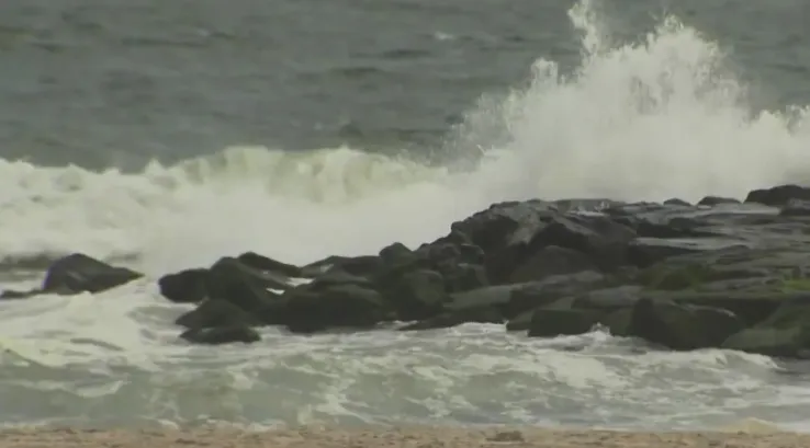
Strong winds and high tides raise concerns for minor coastal flooding. [pix11]
Wind gusts may exceed 40 miles per hour in some locations. These winds could produce blowing and drifting snow, which may reduce visibility significantly. Officials advise commuters to monitor transit updates and prepare for service disruptions.
Coastal Concerns and Nor’easter Development
Meteorologists classify this system as a strong nor’easter due to its coastal track and intensification pattern. As the low-pressure system strengthens offshore, it will draw moisture from the Atlantic Ocean. This process will enhance snowfall rates across inland and coastal communities.
Coastal flooding remains a concern in vulnerable shoreline areas. High tides combined with strong onshore winds may lead to minor to moderate flooding. Local officials continue to monitor water levels and advise residents in flood-prone zones to stay alert.
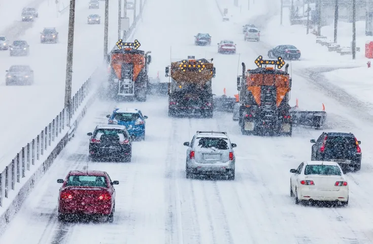
Travel Disruptions and Public Safety Preparations
State and local agencies have activated emergency operations centers in preparation for the storm. Transportation departments pre-treated major highways and bridges to reduce ice formation. Airports in the region have warned of potential delays and cancellations.
Public safety officials recommend that residents stock essential supplies before conditions worsen. They advise keeping mobile devices charged and checking on elderly neighbors. Schools and government offices may announce closures depending on storm progression.
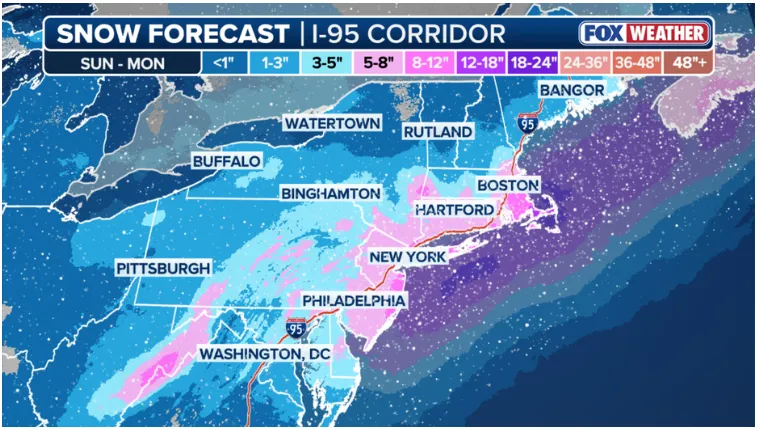
Snowfall Totals and Regional Variations
Forecast models show varying snowfall totals depending on location. Central and northern New Jersey could receive 12 to 20 inches in areas under the heaviest snow bands. Southern New Jersey may see slightly lower totals, though still significant.
Philadelphia’s projected totals range from 6 to 12 inches, while New York City may accumulate several inches to more than a foot in some neighborhoods. Meteorologists note that small shifts in the storm track could alter totals. They will issue updated advisories as new data becomes available.
Also Read: NASA Artemis II: Crewed Lunar Mission Update
Background: Recent Winter Storm Trends in the Northeast
The Northeast has experienced several winter weather events this season, but this storm stands out due to its projected intensity and widespread impact. Nor’easters often bring heavy snow, strong winds, and coastal flooding to the region during late winter.
Forecasters rely on satellite data, computer models, and atmospheric observations to track these systems. Officials continue to refine predictions as the storm approaches landfall. They encourage residents to follow official weather alerts and heed safety instructions.
Authorities expect the storm to move out of the region by late Sunday night. However, cleanup efforts and travel delays may continue into Monday. Residents across New Jersey, Pennsylvania, and New York should prepare for a challenging weekend as this major winter storm develops.
FAQS
- What does a winter storm warning mean?
A winter storm warning means severe winter weather will occur soon or is already happening. It usually involves heavy snow, ice, or a mix of both. These conditions can make travel dangerous and may disrupt power and public services.
Weather agencies issue this warning when snowfall or ice accumulation is expected to reach levels that create serious risks to safety.
- What qualifies as a blizzard?
A blizzard is not defined only by heavy snowfall. It requires strong winds and very low visibility. Winds must reach at least 35 mph, and visibility must drop below one-quarter mile for at least three hours.
Blizzard conditions can occur even if snowfall totals are moderate. The combination of wind and blowing snow creates the greatest hazard.
- When will the snow start and how long will it last?
Snow timing depends on the storm’s track and speed. In most major nor’easter events, snow begins in southern areas first and then spreads northward.
Heavier snowfall often develops overnight when the storm strengthens offshore. Conditions usually improve once the low-pressure system moves away from the coast.
- How much snow is expected in major Northeast storms?
Forecast totals vary by location. Coastal and central areas sometimes receive 8 to 20 inches during strong nor’easters. Inland regions may see lower or higher amounts depending on temperature and storm bands.
Small shifts in the storm’s path can change snowfall totals significantly. Meteorologists update projections as new data becomes available.
- Why do snowfall forecasts change frequently?
Snowfall predictions change because winter storms are complex systems. Temperature differences in the atmosphere can shift precipitation from snow to rain.
In addition, heavy snow often falls in narrow bands. If those bands move slightly, some areas receive more snow while others receive less.
- What is a nor’easter?
A nor’easter is a coastal storm that forms along the East Coast of the United States. It gets its name from the northeast winds that typically blow toward shore.
These storms form when cold air from the north meets warmer Atlantic moisture. This interaction produces heavy precipitation and strong winds.
- How can residents prepare for a major snowstorm?
Residents should monitor official weather alerts and avoid unnecessary travel during peak snowfall. It helps to keep essential supplies at home, including food, water, flashlights, and charged devices.
Drivers should check road conditions before leaving and ensure vehicles have adequate fuel and emergency kits.
- What risks do strong winds create during a snowstorm?
Strong winds can blow and drift snow across roads, reducing visibility. They can also damage power lines and trees, which may lead to outages.
When wind combines with falling snow, travel becomes more dangerous even if snowfall amounts are not extreme.