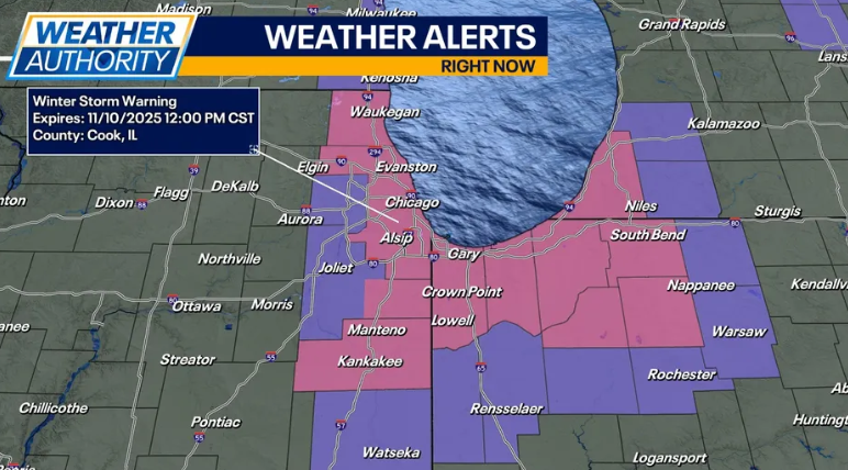
Chicago winter storm warning has been issued as the city faces heavy snowfall and strong winds early Monday. The residents are recommended to get ready for dangerous travel conditions and school closures throughout the region. The National Weather Service recorded that a foot more of snow could fall in various locations by midday.
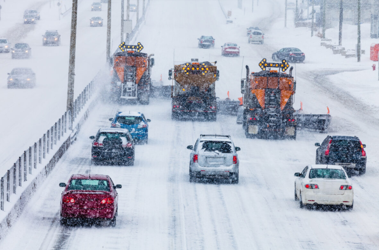
Chicago streets are blanketed in snow as a winter storm warning remains in effect
Northern and southern areas of the city have received a lot of snow through lake-effect snow. In places, the rate of snowfall has gone up to two inches per hour, and the powerful winds of up to 60 mph are causing whiteout conditions on most of the streets. Governments are still using plows and salt trucks to make primary roads usable.
Snowfall in Chicago and in the environs
Northwest Indiana, Lake County, and Kankakee County are most likely to receive the most amount of snow. It was reported at noon that there was a depth of about 9.5 inches of snow north of Valparaiso, less in the counties further west. Besides snow, small hail-like pellets of graupel have been falling in stronger bursts and thus have complicated traveling.
Snowfall map showing expected accumulation across Chicago and northwest Indiana
According to the meteorologists, the snow bands will be shifting towards the east in the morning, presenting intervals of severe snowfall. Drivers are encouraged not to do unnecessary trips since roads are still wet and snow cleaning teams cannot cope with the falling snow.
Disruptions and Conditions of the Road
The road conditions in the Chicago metropolitan area are dangerous. The slow traffic witnessed on major streets and expressways, such as the DuSable Lake Shore Drive, has been attributed to snow cover and poor visibility. Plow crews have been assigned difficulties in keeping pace with fast snowfall due to the introduction of salt spreaders.
Police officers are still patrolling highways and local roads and telling people to be careful. Delays in public transport can occur, and people must ensure they make some inquiries before they travel. Snowfall and strong winds have formed drifting snow, making the less-travelled routes more dangerous.
Closures of schools and E-learning changes
At least a few school districts in Chicago and the surrounding counties have closed their in-person classes or switched to e-learning next Monday. The administrators mentioned safety issues as a reason because of the winter storm warning. The families are urged to visit the local school district websites to find out more about the closures and schedules.
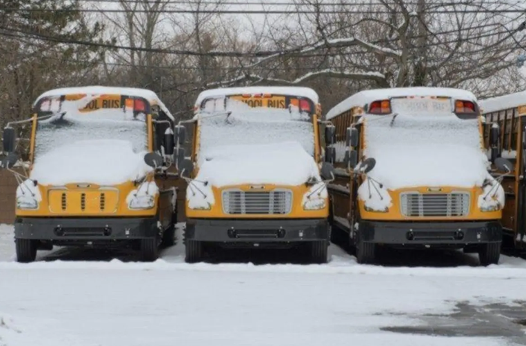
Several Chicago-area schools shifted to remote learning due to heavy snowfall
The school officials stressed that the decisions made rely on road conditions and snowfall rates. Travelling by bus might also be compromised, and students are encouraged not to travel unnecessarily. Districts will keep evaluating states to see when they can reopen later during the week.
Delays at Airports and Flights cancelled
Chicago O’Hare and Midway airports have experienced mass cancellations and delays in flights. It has canceled more than 450 flights in the past 24 hours, and O’Hare has canceled 243 and Midway 130. Most of the delays now take less than 15 minutes, although passengers are expected to check the flight before going to the airport.
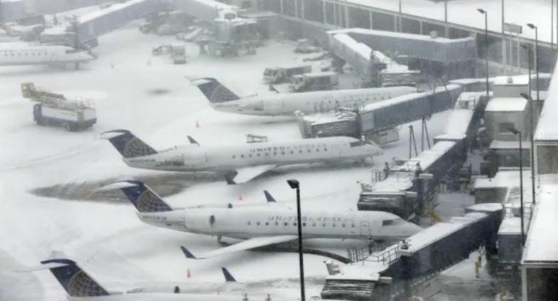
O’Hare and Midway airports face flight cancellations and delays due to the winter storm
Airport officials are still liaising with the airlines to handle schedules and de-ice flights. Disruptions should be anticipated because snow keeps falling on the travelers. The authorities encourage customers to arrive early in order to get through the check-in process and security checks because of the ongoing winter weather.
Weekly Weather Forecast
After the heavy snow on Monday, the area is expected to have mostly cloudy conditions on Veterans Day. It may have light snowfalls, and temperatures will be approximately 40degrees Fahrenheit. Wednesday will be sunny, and the temperatures are supposed to be between the high 40s and mid-40s. Thursday is mostly going to be sunny, and the temperature will be around 50 as well.
It will maintain milder conditions throughout the weekend, with the highs expected in the 60s. On Sunday, rain showers can take place when a warmer air mass enters the region. The weather conditions will be observed and updated to give the forecast of any extra snow or rainfall by the meteorologists.
Also Read: Donald Trump’s Historic NFL Appearance Marks First Presidential Visit Since 1978
Safety Recommendations
Authorities recommend that people stay home when snow occurs the most. There is preparedness of the emergency services in case of accidents, and drivers are encouraged to carry an emergency kit in their cars. The road conditions can vary quickly, and the visibility can be low in the time of heavy snow and strong winds.
The snow removal teams will also keep on clearing the important roads and highways during the day. The citizens are advised to adhere to the local instructions and stay out of the areas with the drifting snow. Animals and pets are to be in shelters, and vulnerable groups are to be provided with heating and supplies.
Final Thoughts
The city of Chicago is having a very difficult beginning of the week, thanks to a winter storm warning. Severe snowfalls on the lakes, strong winds, and dangerous highways have slowed down the daily routine, school activities, and air traffic. The citizens are encouraged to be aware of the local news and to act on instructions by the authorities. Prudent planning and travel are to be undertaken until the conditions get better.
FAQs
- What exactly is a Winter Storm Warning?
A Winter Storm Warning means dangerous winter weather, such as heavy snow, blowing snow, or ice, is expected or occurring in the area. In the Chicago‑region event, the National Weather Service warned of snowfall rates up to 1–3 inches per hour, and white‑out conditions were possible.
- How much snow is expected and over what time frame?
Some areas in the vicinity of Chicago and northwest Indiana have already seen more than a foot of snow. Snowfall rates of up to 3 inches per hour were reported in heavy bands, and the warning remains in effect through Monday morning for several counties.
- Why is lake-effect snow a particular concern in this storm?
Lake-effect snow occurs when cold air moves over the warmer waters of a large lake, picks up moisture, and deposits heavy snow on the downwind side. In this case, bands of heavy lake-effect snow are producing variable and sometimes extreme snowfall across short distances, leading to hazardous travel conditions.
- What are the travel or road-condition concerns associated with this storm?
Travel conditions are dangerous due to heavy snow, blowing/drifting snow, and areas of low visibility. Major expressways and roads, including portions of I‑57 and routes in northwest Indiana, were reported as treacherous or impassable early in the morning commute.
- Are schools and flights being affected?
Yes. Several school districts in the Chicago area have shifted to remote learning or cancelled in-person classes because of the storm conditions. Flight cancellations and delays are also occurring at major airports such as O’Hare and Midway.
- When is this snow expected to taper off?
The primary period of heavy snow is through Monday morning for many counties in the warning area. After the main bands move through, snowfall will become more isolated and the overall intensity is expected to decrease.
- What should residents do in response to the warning?
Residents are advised to limit travel during the heaviest snowfall periods, allow extra time if travel is necessary, and keep updated on local alerts. Ensure proper supplies and readiness for winter conditions, especially if conditions worsen rapidly due to lake-effect bands or strong winds.