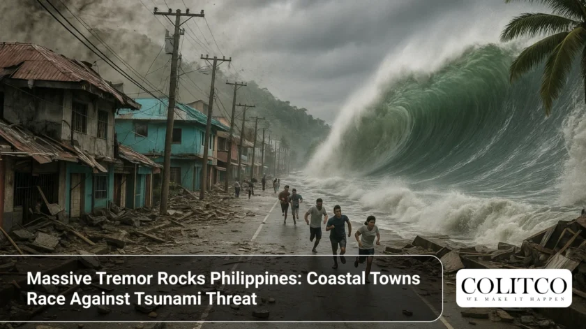
A powerful 7.5-magnitude earthquake struck off the coast of Davao Oriental on Friday morning, triggering urgent tsunami warnings and forcing mass evacuations across southern Philippines. The tremor hit at 9:43 AM local time, sending shockwaves through Mindanao and neighbouring provinces.
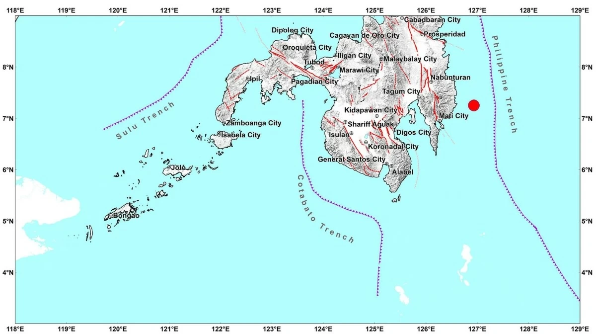
The Philippine Institute of Volcanology and Seismology (PHIVOLCS) initially recorded the quake at 7.6 magnitude before revising it to 7.5. The epicentre lay approximately 44 kilometres northeast of Manay town at a shallow depth of 20 kilometres beneath the seabed.
Tsunami Alerts Send Thousands Fleeing
PHIVOLCS issued an immediate tsunami warning, describing the threat as “destructive” with “life-threatening wave heights.” Authorities expect waves exceeding one metre above normal tides, potentially reaching higher levels in enclosed bays and straits.
The first tsunami waves were forecast to arrive between 9:43 AM and 11:43 AM, with waves potentially continuing for several hours.
Coastal residents in seven provinces received urgent evacuation orders:
- Eastern Samar
- Dinagat Islands
- Davao Oriental
- Southern Leyte
- Surigao del Norte
- Leyte
- Surigao del Sur
President Ferdinand Marcos Jr. mobilised the National Disaster Risk Reduction and Management Council, Office of Civil Defence, Armed Forces, and Philippine Coast Guard. Emergency communication lines were activated across affected regions.
PHIVOLCS earthquake bulletin showing the 7.5 magnitude tremor details.
Government Response Swift but Schools Closed
Davao City officials immediately suspended classes in all public and private schools. The decision allows authorities to conduct rapid damage assessments on buildings and infrastructure before students return.
Cotabato City Mayor Bruce Matabalao followed suit, suspending classes at all levels. The quake was strongly felt throughout Cotabato, prompting residents to rush from homes and offices.
Governor Generoso town in Davao Oriental issued Executive Order No. 38, suspending both classes and government work. Davao De Oro Governor Raul Mabanglo announced similar measures, though frontline offices remain operational.
Intensity Readings Span Mindanao
The US Geological Survey measured the earthquake at 7.4 magnitude with a depth of 58.1 kilometres. PHIVOLCS reported varying intensity levels across affected areas.
Intensity V (strong shaking) was recorded in:
- Davao City
- Hinunangan, Southern Leyte
- Gingoog City, Misamis Oriental
- Nabunturan, Davao de Oro
- Kidapawan City, Cotabato
- Multiple locations in Sarangani and South Cotabato
Intensity IV (moderately strong) reached as far as Cebu City, still recovering from a devastating 6.9 magnitude earthquake on September 30 that claimed 72 lives.
Second Major Quake in Two Weeks
The latest tremor compounds an already dire situation. The September 30 Cebu earthquake struck at 9:59 PM, collapsing buildings and displacing over 20,000 people. More than 340 aftershocks followed that event, with some reaching magnitude 4.8.
Hospitals in Cebu remain overwhelmed with injured patients. The death toll from that earthquake reached 74, with 559 injured. Infrastructure damage exceeded ₱3 billion ($4.6 million).
The Cebu earthquake was described by PHIVOLCS as the strongest ever recorded in northern Cebu. The newly named Bogo Bay Fault was identified as the source after surface ruptures and fault scarps were documented.

Students gathering outside school buildings in Davao de Oro after the earthquake struck
Pacific Ring of Fire Claims Another Victim
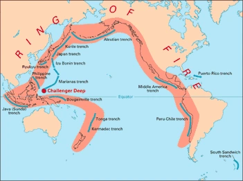
The Philippines sits squarely on the Pacific Ring of Fire—a 40,000-kilometre arc of seismic fault lines circling the Pacific Ocean. This volatile zone hosts more than half the world’s volcanoes and experiences regular powerful quakes.
The Philippine archipelago formed through tectonic activity between the Eurasian and Pacific plates. This geological reality makes earthquakes an ever-present threat across the nation.
Historical data shows the Philippines experiences measurable earthquakes (greater than magnitude 2.5) almost daily. Most go unnoticed by the general population.
The 1990 Luzon earthquake killed 2,400 people. The 2013 Bohol earthquake caused 222 fatalities and substantial damage across the island. These disasters remain fresh in national memory.
Indonesia Issues Tsunami Warnings Too
Indonesia’s geophysics agency warned that tsunami waves up to 50 centimetres could hit northern Sulawesi shorelines. The agency advised coastal residents to remain vigilant and prepared to evacuate.
The US Tsunami Warning System predicted wave heights of 1-3 metres for parts of the Philippines. Some Indonesian coasts and Palau could experience waves between 30 centimetres and one metre.
No Major Damage Reported Yet
Initial reports indicate no major casualties or structural damage. However, authorities caution that comprehensive assessments take time.
Preliminary field reports mention scattered injuries. The full extent of losses and damage remains uncertain as disaster response teams continue surveying affected areas.
Power outages have affected some communities. Communication disruptions in remote coastal villages complicate damage assessment efforts.
The Philippines’ location on the Pacific Ring of Fire makes it highly vulnerable to seismic activity.
Expert Analysis and Preparedness
The shallow depth of today’s earthquake, just 20 kilometres below the surface, amplified its impact. Shallow quakes are felt more intensely than deeper ones because seismic waves travel shorter distances to reach the surface.
PHIVOLCS Director Teresito Bacolcol confirmed that damage and aftershocks are expected. The agency continues monitoring seismic activity closely.
The Philippines’ experience with natural disasters has improved emergency response capabilities. However, the rapid succession of major earthquakes in October tests even well-prepared systems.
Local governments across Mindanao have placed disaster response teams on high alert. Rescue equipment stands ready for deployment to affected areas.
Historical Context Matters
The region experienced a similar event in August 2021 when a magnitude 7.1 earthquake struck near Davao Oriental. That quake generated tsunami waves measuring 6.1 centimetres at Bitung, Indonesia, and 3 centimetres at Davao City.
The Verde Island Passage tsunami of November 1994 killed 41 people. That event followed a 7.1 magnitude earthquake, generating waves up to 8.5 metres in some locations.
These historical precedents inform current evacuation protocols and emergency response strategies.
What Happens Next
Authorities will continue monitoring tsunami activity throughout Friday. Coastal residents must remain on high alert even after initial wave forecasts pass.
Aftershocks could continue for days or weeks. Some may be strong enough to cause additional damage or trigger further tsunami warnings.
Building inspections will determine when schools and workplaces can safely reopen. This process could take several days in harder-hit areas.
The National Disaster Risk Reduction and Management Council will coordinate relief efforts. Distribution of emergency supplies to displaced families has already begun.
Also Read: RBA Chief Under Pressure: What Michele Bullock Must Answer at Senate Hearing
Frequently Asked Questions
Q: How strong was the earthquake in the Philippines today?
A: PHIVOLCS recorded a 7.5 magnitude quake, initially reported as 7.6. The US Geological Survey measured it at 7.4 magnitude.
Q: Where exactly did the Davao earthquake occur?
A: The epicentre was located 44 kilometres northeast of Manay town in Davao Oriental province, at a depth of 20 kilometres.
Q: Is there still a tsunami warning in effect?
A: Tsunami warnings remain active for coastal areas of Eastern Samar, Dinagat Islands, Davao Oriental, Southern Leyte, Surigao del Norte, Leyte, and Surigao del Sur.
Q: How many people were evacuated?
A: Specific evacuation numbers are still being tallied, but thousands of coastal residents fled to higher ground following PHIVOLCS warnings.
Q: Why does the Philippines experience so many earthquakes?
A: The country sits on the Pacific Ring of Fire, where tectonic plates meet. This geological reality causes frequent seismic activity and volcanic eruptions.
Q: Was this earthquake related to the recent Cebu quake?
A: No direct relationship exists between the September 30 Cebu earthquake and today’s Mindanao event, despite their proximity in time.